TheJakartaPost
Please Update your browser
Your browser is out of date, and may not be compatible with our website. A list of the most popular web browsers can be found below.
Just click on the icons to get to the download page.

Nusa Dua earthquake: Rock sediment triggers strong jolts
The Volcanology and Geological Hazard Mitigation Center revealed that the carbonate and volcanic rocks surrounding the epicenter of the magnitude-6 earthquake in the sea southwest of Bali Island intensified the shocks, but ensured that no risk of tsunami was detected.
Change Size
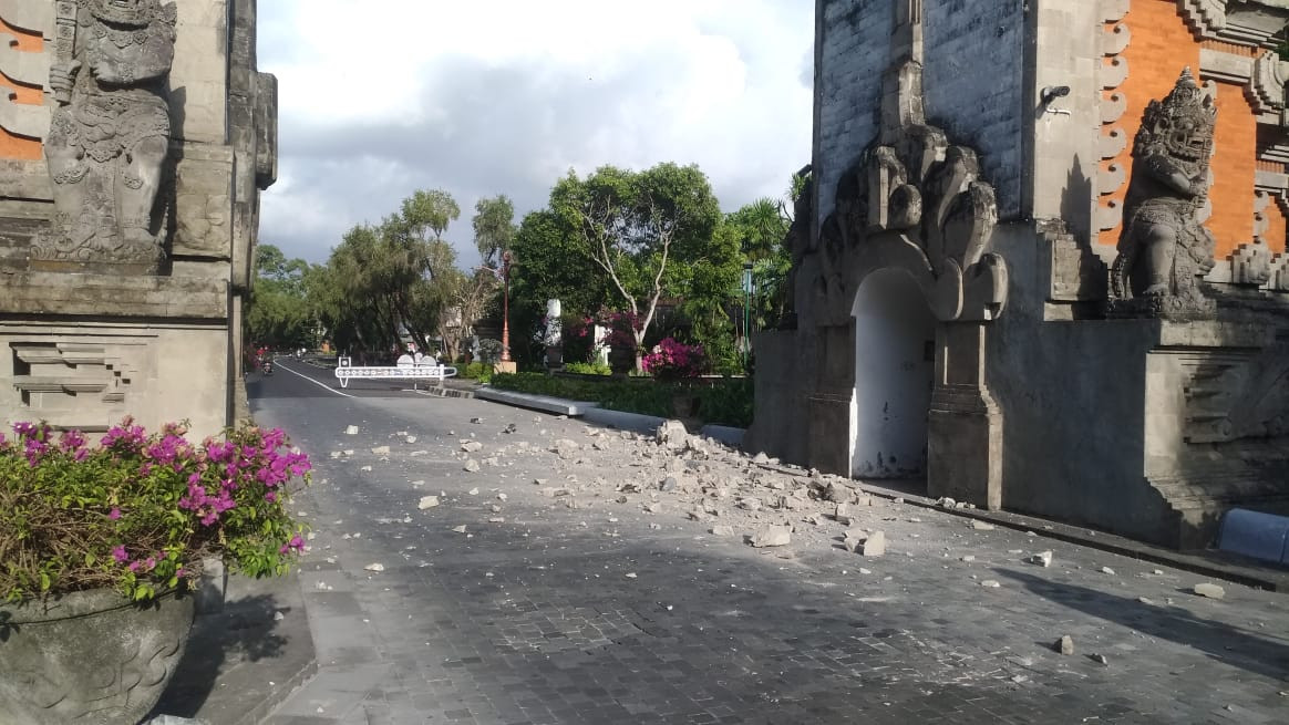 The entrance to the Nusa Dua hotel complex is damaged during a magnitude-6 earthquake near Bali on July 16. (Courtesy of BPBD Bali/-)
The Volcanology and Geological Hazard Mitigation Center (PVMBG) revealed that the carbonate and volcanic rocks surrounding the epicenter of the magnitude-6 earthquake in the sea southwest of Bali Island intensified the shocks, but ensured that no risk of tsunami was detected.
"Weathered rocks that were not yet compact and were untrammeled in nature will intensify the shock effects of the quake, hence people would feel it more," PVMBG head Kasbani said in a written statement on Tuesday.
The PVMBG said the earthquake was recorded to have taken place at 8:18 a.m. local time on Tuesday, 83 kilometers southwest of Nusa Dua, Bali, at a depth of 65 kilometers. Given the location and depth of the epicenter, Kasbani predicted that quake was linked to a subduction zone between the Eurasian and Indo-Australian plates.
Data recorded by a German research center, GFZ-Postdam, meanwhile, put the quake at a 5.7 magnitude and at a depth of 95 km.
The Meteorology Climatology and Geophysics Agency reported that the quake could be felt across Bali, on Lombok Island in West Nusa Tenggara and also in some parts of East Java.
Reports from nearby volcanoes revealed that the shocks were also felt on Mount Batur and Mounth Agung in Bali; Mount Raung in Banyuwangi, East Java, and Mount Rinjani on Lombok.
"The quake won't lead to tsunami because it didn't create any dislocation in the seabed," Kasbani said. (ars)