TheJakartaPost
Please Update your browser
Your browser is out of date, and may not be compatible with our website. A list of the most popular web browsers can be found below.
Just click on the icons to get to the download page.

Popular Reads
Top Results
No results found. Please check your search term and try again
Can't find what you're looking for?
View all search resultsPopular Reads
Top Results
No results found. Please check your search term and try again
Can't find what you're looking for?
View all search resultsPlanet’s satellite imagery may assist Indonesia in monitoring deforestation
The conference resulted in countries pledging to achieve net-zero emissions by 2050, in line with the agreement to reduce global warming to 1.5 degrees Celsius.
Change text size
Gift Premium Articles
to Anyone
Share the best of The Jakarta Post with friends, family, or colleagues. As a subscriber, you can gift 3 to 5 articles each month that anyone can read—no subscription needed!
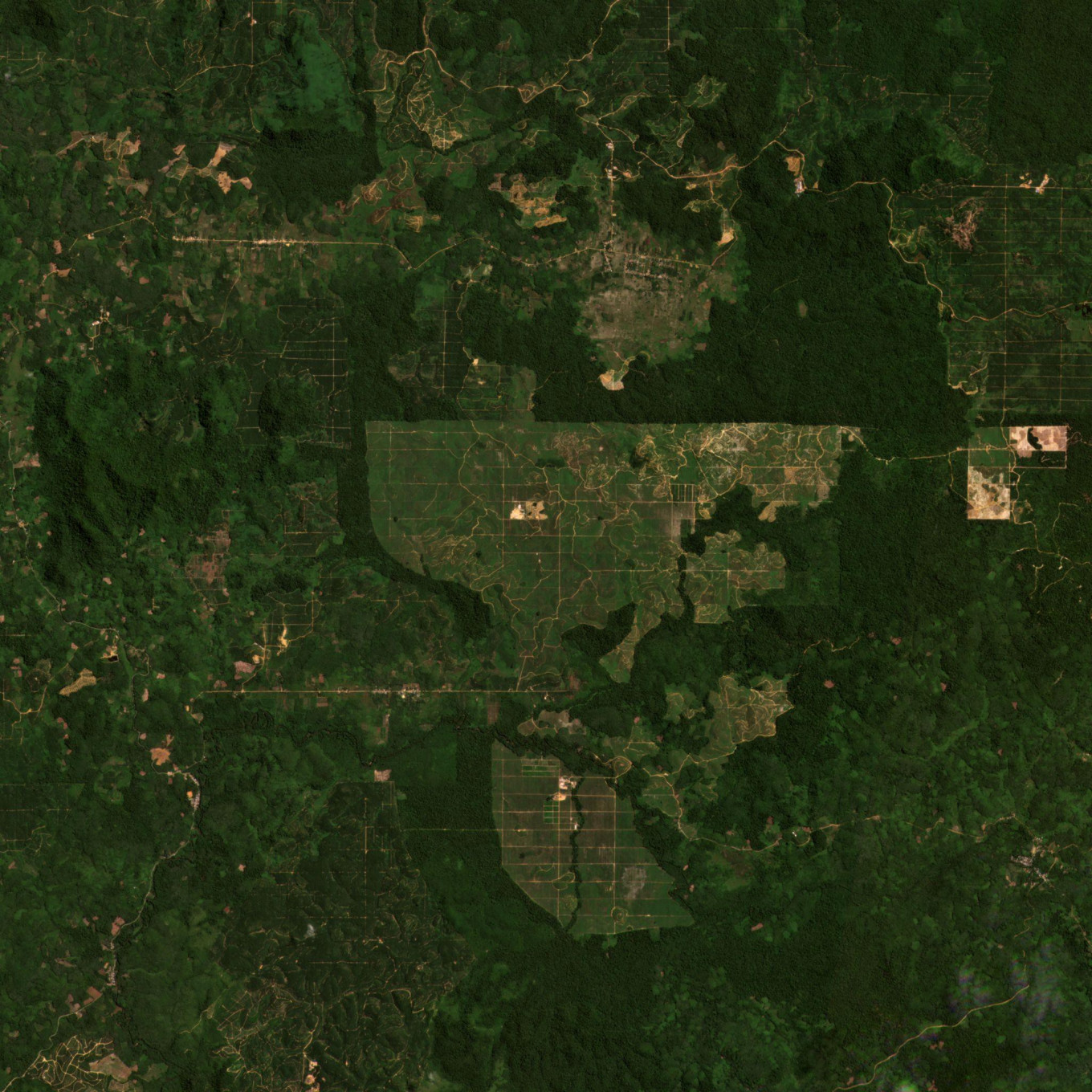 PlanetScope imagery of Palm oil plantation in Pangkalan Suka, Indonesia. © 2021, Planet Labs, Inc. All Rights Reserved.
The United Nations Framework Convention on Climate Change (UNFCCC) has completed its COP26 conference in Glasgow, Scotland.
The conference resulted in countries pledging to achieve net-zero emissions by 2050, in line with the agreement to reduce global warming to 1.5 degrees Celsius. It means global greenhouse gas (GHG) emissions must stay below the carbon sequestration capacity of the planet.
As leaders at COP26 recognized that the world's forests are the most efficient sequester of carbon dioxide, they universally decreed a global moratorium on deforestation if the world is to reach the 2025 net-zero goal.
Indonesia is one of the many countries that have pledged to put an end to deforestation. However, implementing such a policy may prove to be an enormous undertaking as Indonesia’s many islands are spread far and wide. Efficiently monitoring illegal encroachment into forest areas would be near impossible and very costly by physical means.
This is where satellite imagery technology shows the most promise as a cost-effective option.
Planet operates the world’s largest constellation of observation satellites. They can capture daily data and store it into an extensive archive for every location on the Earth’s surface. Planet’s unique global scanning system can capture the Earth’s entire landmass at a medium resolution on an almost daily basis. Planet also offers a rapid revisit high-resolution capability with 0.5 m resolution between two and five revisits per day.
With the support of Planet’s satellite imagery, it would no longer be an impossibility for the Indonesian government to monitor the large swathes of tropical forests spanning the country of more than 270 million people.
Indonesia’s commitment to ending deforestation is a step in the right direction as a demonstration to the world that Indonesia is devoted to fighting climate change. As countries worldwide are implementing more ways to punish deforestation practices such as banning imports, Indonesia has no choice but to show evidence of its no deforestation policies. By doing so, Indonesia may escape restrictions on its land-based commodities, including palm oil, rubber and timber.
Discover how Planet can support the Indonesian government with imagery and data necessary to make informed decisions on the safety and development of the country. This includes, but is not limited to, defense and intelligence, agriculture monitoring, forestry, disaster monitoring and planning, smart cities and waste pollution crisis. Download the whitepaper on Planet satellite imagery for the Indonesian government to learn more.