Popular Reads
Top Results
Can't find what you're looking for?
View all search resultsPopular Reads
Top Results
Can't find what you're looking for?
View all search resultsJakarta without a master plan
Believe it or not
Change text size
Gift Premium Articles
to Anyone
B
elieve it or not. The Jakarta urban development budget for 2011 was passed without a clear legal umbrella. This is related to the master plan or the spatial planning (RUTR) of Greater Jakarta for 2010-2030.
Currently there are no regulations on the applicable master plan because the 2000-2010 Jakarta master plan has already expired, while the draft master plan for 2010-2030 should have been passed in Jakarta before 2010 ends.
This is clearly a bad precedent for the development of Jakarta, because it proved that the development of the city can continue to take place without the need for a master plan. So do not be surprised if Jakarta has a chaotic urban spatial planning, traffic jams, flooding and rob getting worse.
The absence of the master plan and the slow adoption of Jakarta 2010-2030 master plan indicate attraction between the interests of the provincial government, parliament and major developers.
The master plan will determine the pattern of space utilization, economics, transportation and environment of Jakarta. In the draft master plan Jakarta 2010-2030, which consists of 21 chapters and 358 articles, containing strategic issues and problems faced, goals and development targets, strategic targets and anticipation of problems, and plans to realize the strategy in the macro structure, the pattern space is written in a variety of map space utilization plans. Issues of disaster and mitigation efforts and adaptation to climate change will not be discussed thoroughly.
Ironically, the master plan, which will determine the fate of the residents, was not known by its own people. How many people know that the draft was still parked at the local legislative. The board is still waiting for some improvement of the content of the draft local government. One is input from citizens.
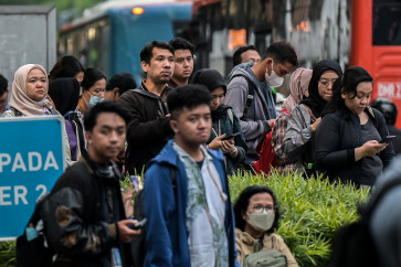
However, how can citizens provide input if they just do not have access to information. There was hardly any grounded communication. There is no direct dialogue at the pockets of the crowd, such as terminals, rail stations, busstops, offices, hospitals, schools, markets and shopping centers. Residents also do not know the procedure for submitting feedback and objections about the content of the substance of a master plan. Though very important for people to understand and be advised on how Jakarta will be built for (at least) 20 years.
On the other hand, people also experience difficulty in providing input through the official site: www.rtrwjakarta2010-2030.com.
A lack of disclosure of information about the city’s master plan makes people never know where the city will be brought to.
The issue is not about whether the participation process has or has not been undergone alone, but most importantly it is about how the public participation process can reach a level of presence and activity in the daily lives of its citizens, to accommodate the proposed stakeholders to provide input for technical planning.
Local governments must explain in detail to the public the reasons, risks and consequences of decisions that have been taken and poured in a master plan.
The council members should come down directly to the field to meet and hold dialogue with community members, especially in vulnerable areas of development changes, such as markets, terminals, schools, solid housing, slums, areas prone to floods and fires. Dig up as much information from every element of society, business, and education.
Under the 2007 Spatial Planning Law and the 2009 Management and Environmental Protection Law, spatial planning must also be equipped with Strategic Environmental Assessment (KLHS), so that spatial planning is integrated with the area of Bogor, Depok, Tangerang, Bekasi and Cianjur (Bodetabekjur) and involves environmental conservation.
The Jakarta Provincial Administration should immediately issue a comprehensive disaster-prone map illustrating the current state of each region that is threatened by inundation, the rate of land subsidence, seawater intrusion, fire and earthquake. Maps can be made partially by region and published widely in public places to arouse the collective consciousness of citizens on the local environmental conditions.
The map should be translated in a language that is easily understood by the public. Its design should be appealing and attractive. Residents are given the opportunity to know their own environment and provide insights into the development plan area to improve the quality of life and welfare of the community in the future.
An understanding of the environmental conditions alone will trigger a sense of intimacy, so that it is easier to encourage people to fix their own region.
The existence of a disaster-prone map at each location is expected to be able to help the capital city adapt with the master plan and mitigation of disasters and climate change (floods, inundation, rob, abrasion, intrusion, land subsidence, earthquake), at least for the next 20 or even 100 years.
The draft master plan should be revised. It would be wise if input from the public be collected to refine the 2010-2030 Jakarta master plan. The provincial administration and council should immediately meet to set targets that would legalize the master plan.
The writer is chairman of the Indonesia Landscape Architecture Study Group, Jakarta.


