New president and wetland data
Food sovereignty has been an issue addressed by the two candidates in the 2014 presidential election
Change Size

F
ood sovereignty has been an issue addressed by the two candidates in the 2014 presidential election.
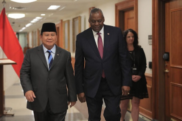
The issue is stated clearly in their vision statements. Candidate pair Prabowo Subianto-Hatta Rajasa promise to open up 2 million hectares (ha) of wetland rice fields if elected. A similar initiative has also been announced by the Joko 'Jokowi' Widodo-Jusuf Kalla candidate pair, which will open up 1 million ha of wetland area outside Java if elected.
Indonesians should understand that wetland area data is the baseline in validating data on harvested areas, the main variable used in food production forecasts in the country besides productivity. However, the mystery of wetland area data in Indonesia has not been revealed.
The Central Statistics Agency (BPS) has been a safeguard for years and has been accidently responsible for wetland area data that was not produced by the institution. Since 1973, area data, including planted areas, harvested areas and land use data, have been collected by the District Agriculture Service. The BPS has only been responsible for data processing and dissemination.
A government regulation in 2012 clearly stated that the sustainable agricultural land information system was under the National Land Agency's (BPN) responsibility. In addition, the BPS is only responsible for providing basic information on human resources and social economic data such as population, farmer families, farmer organizations and related rural organizations.
Up to 2011, land use data is collected based on 'inheritance' data from one enumerator to its successor. Data was collected based on the land status, which could be assumed to be not very different from real land use.
However, after government decentralization, land status is no longer the same as land use. Most local governments are reluctant to change wetland status due to several hidden reasons such as the unsuccessful image of agricultural programs, budget cuts and discounted subsidies for their district.
On the other hand, the history of data is not inherited perfectly from one enumerator to its successor. Consequently, data recorded by the new enumerator is unexplainable and is without a sound collection methodology.
The wetland area data series shows that wetland areas in Indonesia increased from 7.74 million ha in 2005 to 8.10 million ha in 2011. The positive trend that occurred both in Java and outside Java is hardly acceptable, considering the high expansion of new housing and urban facilities that reduced the wetland area.
The latest data available is the preliminary figure of wetland area from the BPS, which estimated the wetland area in 2012 to be as much as 8.13 million ha, consisting of 3.44 million ha of wetland areas in Java and 4.69 million ha of wetland areas outside Java.
The data was compiled through land mapping called land audit, conducted by the Agriculture Ministry using high resolution satellite imagery with the adoption of geographic information systems (GIS) and remote sensing technology.
Despite the sound and scientific methodology of data collection, it's not easy to persuade local governments to openly accept the data, especially District Agriculture Services, which get lower acreage than the previous data.
The refusal is triggered by strong concerns about wetland area reduction impacts on food production data. In fact, wetland areas are closely correlated to food production data in a district.
Without doing anything, rice production will be corrected negatively by 50 metric tons if the wetland area is corrected by minus 10 ha. On the other hand, districts with higher wetland area data will fully accept the land audit result.
Besides the data refusal, another obvious problem is the sustainability of the satellite imagery update. The GIS and remote sensing method are costly and very time consuming. It is still uncertain who will update the data. It is sad that land data collection will go back to the old and conventional unsound method.
Hopefully, food sovereignty in the visions of the presidential candidates will be supported by more accurate land use data. Whoever the president is, he must place land-use data as a main priority in his action plan.
The writer is the head of evaluation and reporting on food crops statistics, the Central Statistics Agency (BPS). The opinions expressed are his own.


