TheJakartaPost
Please Update your browser
Your browser is out of date, and may not be compatible with our website. A list of the most popular web browsers can be found below.
Just click on the icons to get to the download page.

Popular Reads
Top Results
No results found. Please check your search term and try again
Can't find what you're looking for?
View all search resultsPopular Reads
Top Results
No results found. Please check your search term and try again
Can't find what you're looking for?
View all search resultsTokyo station maps to be standardized
Tokyo will standardize station maps at train and subway stations for the 2020 Olympic and Paralympic Games.
Change text size
Gift Premium Articles
to Anyone
Share the best of The Jakarta Post with friends, family, or colleagues. As a subscriber, you can gift 3 to 5 articles each month that anyone can read—no subscription needed!
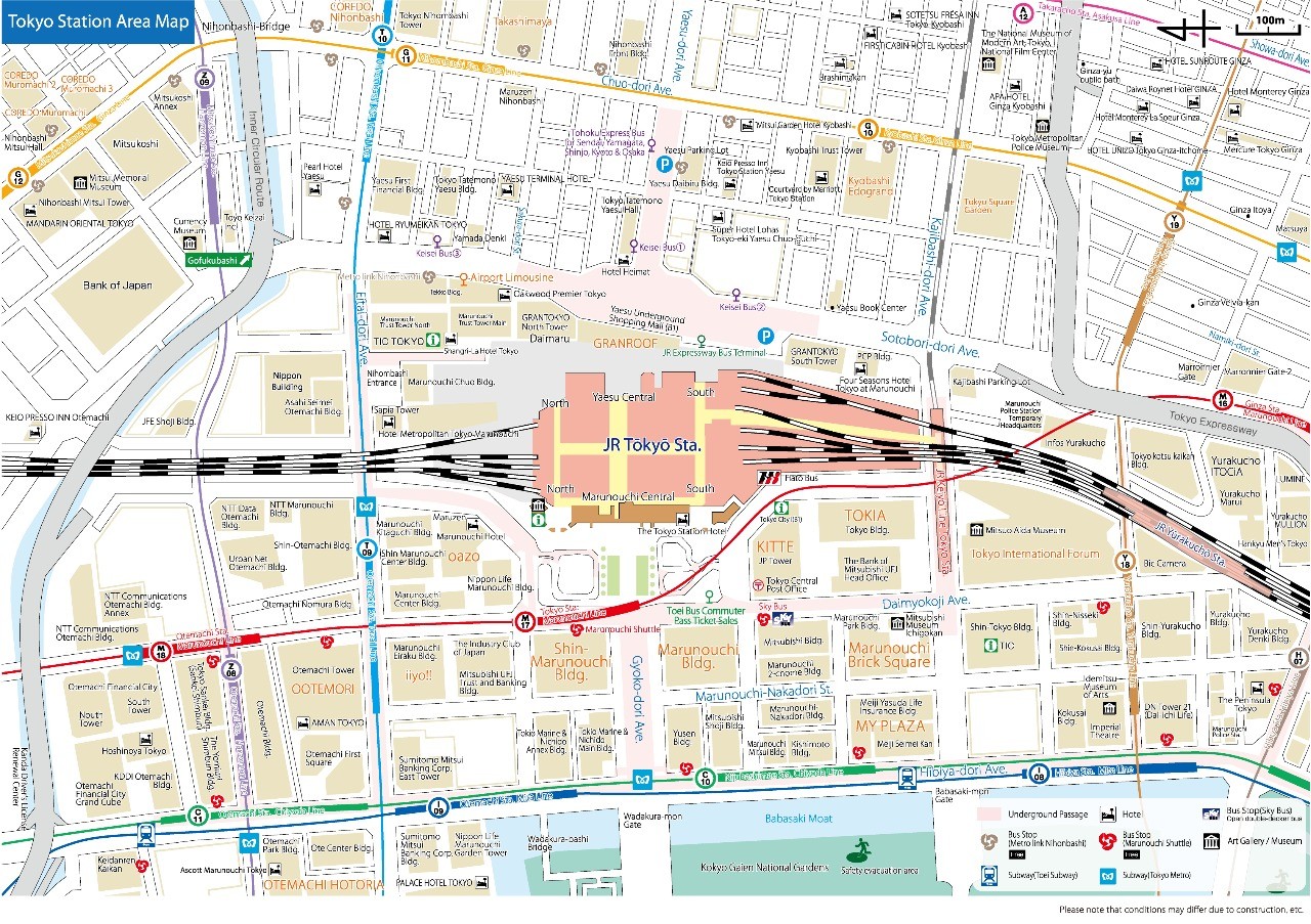 Tokyo Station Map (www.tokyostationcity.com/-)
T
he Land, Infrastructure, Transport and Tourism Ministry is planning to standardize station maps at train and subway stations in Tokyo in preparation for the 2020 Olympic and Paralympic Games.
The designs of such maps currently vary among railway and subway operators. The ministry intends to make them easier to understand and use for everyone, including tourists from overseas and wheelchair users.
Under the ministry’s timetable, the standardized maps will be used at Tokyo Station and seven other main stations in the capital in fiscal 2018, followed by other stations near Olympic venues from fiscal 2019.
Station maps indicate the location of ticket counters, elevators, toilets for wheelchair users and other facilities. As well as being installed at stations, maps can also usually be found on the websites of rail and subway operators.
However, the designs of the maps differ among operators, which can make it difficult for train users to find their way between a station and adjacent buildings, among other problems.
Therefore, the ministry has decided to standardize the maps following the format the Geospatial Information Authority of Japan uses for indoor facility maps, adding information from operators indicating the locations and sizes of elevators, toilets and other station facilities.
The eight stations that will get the new maps in fiscal 2018 include Tokyo, Otemachi, Ginza and Shinjuku stations. East Japan Railway Co., Tokyo Metro Co., Toei Transportation and other railway and subway operators plan to cooperate.
The ministry is considering including expenses for the project in the budgetary request for its fiscal 2019 budget so that maps at stations, especially ones near the Olympic and Paralympic venues, can be replaced ahead of the Games.
The ministry will provide smartphone application developers and others with the new maps, which will be treated as open data that can be used for free, in a bid to encourage them to create useful apps that combine the map data with other information, such as service delays, congestion and weather forecasts.
This article appeared on The Japan News newspaper website, which is a member of Asia News Network and a media partner of The Jakarta Post