TheJakartaPost
Please Update your browser
Your browser is out of date, and may not be compatible with our website. A list of the most popular web browsers can be found below.
Just click on the icons to get to the download page.

Popular Reads
Top Results
No results found. Please check your search term and try again
Can't find what you're looking for?
View all search resultsPopular Reads
Top Results
No results found. Please check your search term and try again
Can't find what you're looking for?
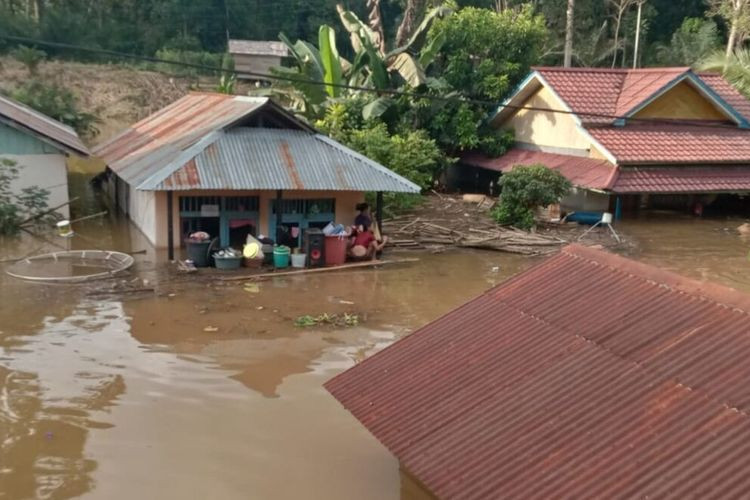
View all search resultsFloods not caused by deforestation: Govt
Rainfall surpassed Barito River capacity: Jokowi
Change text size
Gift Premium Articles
to Anyone
Share the best of The Jakarta Post with friends, family, or colleagues. As a subscriber, you can gift 3 to 5 articles each month that anyone can read—no subscription needed!
T
he government has downplayed any link between deforestation and tree cover loss and the recent widespread floods in South Kalimantan, saying the devastation was primarily caused by a weather anomaly.
Rare and extreme rainfall was the main trigger, President Joko “Jokowi” Widodo and his subordinates said of the major floods, which so far have killed at least 15 people and displaced more than 100,000 others.
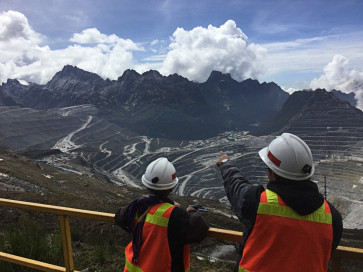
During his visit to the flood-affected Banjar regency on Monday, Jokowi said the intensity of rainfall had surpassed the capacity of the Barito River, the largest river in the province that originates in Central Kalimantan. He said rainwater with a volume of 2.1 billion cubic meters had entered the river, exceeding its normal capacity of 230 million cubic meters.
The Environment and Forestry Ministry concurred with the President, saying the floods that had hit 11 out of 13 regencies and cities were due to extreme rainfall with a recurrent period of 50 to 100 years and that they were not because of a lack of forest area.
“We are clarifying this in order to [limit any confusing information] and to provide appropriate recommendations for policymakers, especially local governments, in disaster mitigation,” the ministry's pollution and environmental damage control director general, RM Karliansyah, told a press briefing on Tuesday.
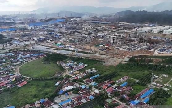
The ministry acknowledged a 62.8 percent decrease in natural forest area in the Barito watershed section in South Kalimantan in the last three decades, but it said the division of the area had met the standard proportions.
The watershed section in South Kalimantan, covering 1.8 million hectares of the total 6.2-million-ha watershed, is divided into 39.3 percent forest area and 60.7 percent other-use area, with 43.3 percent of the forest area forested, the ministry reported.
Read also: S. Kalimantan declares state of emergency as flooding displaces more than 20,000
“The watershed here is indeed dominated by land for the community or so-called areas for other uses,” said Environment and Forestry Ministry director of inventory and monitoring of forest resources Belinda Arunarwati Margono.
However, a more holistic picture of the entire watershed area was needed when discussing the flooding, Belinda suggested, because the upstream of the Barito watershed area is found to be dominated by forest area.
Due to vast differences in height between upstream and downstream, the water surged with much higher intensity and volume, causing it to flow faster and inundate the floodplain, the ministry said.
The ministry's director of planning and evaluation of watershed control M. Saparis Soedarjanto said that even before the flooding occurred, his ministry had continued to reduce non-forested areas through revegetation efforts or tree planting, including in three catchment areas of the flooded watershed since 2019.
“Because we have only done it massively in the last few years, [the results] may not yet be clearly visible on the map now,” he said, adding that other intensive rehabilitation activities, including forcing reclamation obligations for miners, had also been put in place.
Bogor Agricultural University (IPB) forestry expert Bambang Hero argued that the flooding was an indication of disturbances in spatial planning and the ecosystems, saying that the heavy rain merely acted as a trigger.
“It cannot be denied that there are problems in land use in the areas affected by the floods. It could be that the watershed area itself is disturbed, thus causing an inability in the ecosystem to contain rain, especially on a larger scale,” he told The Jakarta Post on Wednesday.
Read also: 2020 weather disasters boosted by climate change: Report
According to available data, the abandonment of mining land, in addition to land and forest fires, had occurred extensively and caused a disturbance to the ecosystem that had been happening since way before 2019.
The National Institute of Aeronautics and Space (Lapan) reported on Sunday that from 2010 to 2020, South Kalimantan experienced a shrinkage of 13,000 ha of primary forest, 116,000 ha of secondary forest, 146,000 ha of rice fields and 47,000 ha of shrubbery. The institute said that forest shrinkage might have contributed to the increased risk of flooding in the province.
“The problem is that after an improper change in land use, have there been enough recovery efforts?” said Bambang.
Forest cover has the effect of strengthening the soil’s binding capacity, which could not be linked to the division of forest and non-forest areas, even across different land uses, said Hariadi Kartodihardjo of IPB’s Board of Professors.
“There is never only a single factor causing flooding. The floods indicate that the binding capacity is exceeded by the rain intensity,” Hariadi said, agreeing that the government’s long-term calculations were ineffective to anticipate such heavy rains.
The loss of forests had decreased the resilience of our ecosystems to climate change, said Center for International Forestry Research (CIFOR) senior scientist Herry Purnomo, although he did not specifically refer to South Kalimantan’s case.
“It is clear that local flooding is easier [to determine the cause of] than landscape matters, but for such massive flooding, there are many factors that influence it,” he said.
The widespread floods in South Kalimantan have affected all but two regencies and cities, with Hulu Sungai Tengah, Banjar and Tanah Laut regencies heavily hit. The provincial administration declared a state of emergency earlier this week.
The start of 2021 has been rife with natural disasters, partly due to the peak of the rainy season, which meteorologists have predicted to occur at the end of January and early February.