Popular Reads
Top Results
Can't find what you're looking for?
View all search resultsPopular Reads
Top Results
Can't find what you're looking for?
View all search resultsHeavy rains cause floods in Bandung, Yogyakarta
Heavy rain over the past few days has caused floods in a number of places, including the West Java capital of Bandung and Yogyakarta's sand quarrying areas on the slope of Mt
Change text size
Gift Premium Articles
to Anyone

Heavy rain over the past few days has caused floods in a number of places, including the West Java capital of Bandung and Yogyakarta's sand quarrying areas on the slope of Mt. Merapi.
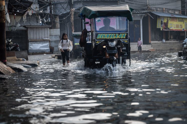
In West Bandung, at least 200 homes in Baleendah district, 20 kilometers from central Bandung, have been inundated with floods since Wednesday last week.
Residents said the water level lowered at one point but surged back Monday as heavy rains continued, submerging the region in a meter of water.
"People here are accustomed to floods. Every time heavy rains fall, floods are sure to follow," Dedi Hardiana, resident of Cieunteung village told The Jakarta Post Wednesday.
The flooded residential complex is located near the junction of the Citarum River and Cisangkuy Tributary. Those who live close to the river have since moved to relative's homes.
Head of Baleendah district, Ruli Hadiana, said his administration had not made any anticipatory measures, arguing it was a recurrent flood.
He said his office had prepared refugee sanctuaries and logistic needs should the flooding become serious.
"We held meetings with the regency administration officials to determine a solution. Yet, the key is in Citarum. If the river is not overflowing, then floods will not occur either," Ruli said.
Separately, West Java Governor Ahmad Heryawan reminded his people of the importance of rehabilitating the province's 220,000 hectares of critical fields to minimize possible floods and landslides.
In Yogyakarta, heavy downpours over Mt. Merapi have turned mudflows, deposited during the 2006 eruption, into rivers along the slope of one of the world's most active volcanoes.
Locals said there were at least two major floods over the past week. One swept away a sand-quarrying truck Tuesday near Gendol River in Cangkringan district, Sleman regency.
Despite being prone to floods during the rainy season, hundreds of people are still conducting sand quarrying activities in the river.
"We cannot simply stop. This is the way we support our families. So, we try and be very cautious. When rain is falling over the top of Mt. Merapi, we promptly leave the river area," Sukamto, a local, said.
There is believed to be over 500,000 cubic meters of volcanic material remaining at the peak of the volcano from the 2006 eruption, which reportedly released over 2 millions cubic meters of lava.
To warn of any possible floods, the five monitoring posts on the slope of Mt. Merapi have been permanently operational. The posts are in Babadan (Magelang, Central Java), Pos Ngepos (Magelang), Kaliurang (Sleman, Yogyakarta), Jrakah (Klaten, Central Java) and Selo (Boyolali, Central Java).
"All the posts' staffers are on full alert," Head of Volcanology Center, Mt. Merapi section in Yogyakarta, Sri Sumarti, said.


