TheJakartaPost
Please Update your browser
Your browser is out of date, and may not be compatible with our website. A list of the most popular web browsers can be found below.
Just click on the icons to get to the download page.

Uber to improve data service using satellite imagery
Uber is reportedly set to use high resolution satellite imagery for gain better data on pick-up and drop-off locations following the creation of a partnership with DigitalGlobe.
Change Size
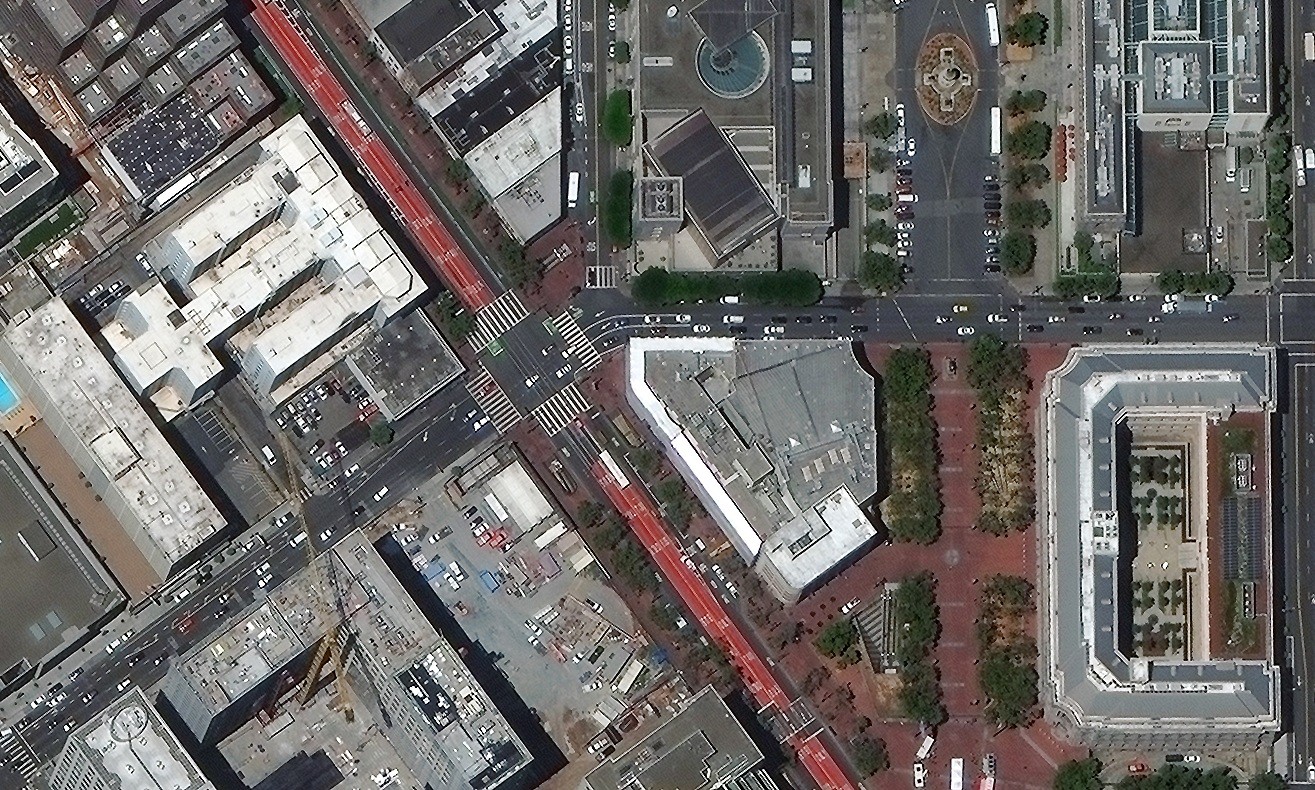 A partnership with a satellite company is said to give Uber access to information on road changes, as DigitalGlobe refreshes its maps frequently.
(DigitalGlobe/-)
A partnership with a satellite company is said to give Uber access to information on road changes, as DigitalGlobe refreshes its maps frequently.
(DigitalGlobe/-)
U
ber is reportedly set to use high resolution satellite imagery for gain better data on pick-up and drop-off locations following the creation of a partnership with DigitalGlobe.
DigitalGlobe is a satellite imaging company that provides information to Google Maps, Google Earth and Apple’s Terraserver.
"Today we are announcing a multi-year, global partnership with Uber to supply high resolution satellite imagery, which will help improve the Uber experience for riders and drivers around the world," stated DigitalGlobe business development director Kevin Bullock in a press release on Tuesday.
(Read also: Pokémon Go Uber could be the next big thing)
This partnership is said to give Uber access to information on road changes, as DigitalGlobe refreshes its maps frequently.
Uber is obviously very serious about its mapping feature, as it reportedly hired Manik Gupta, who led Google Maps, just last year and recently purchased a significant portion of Microsoft’s mapping division, including its employees, reported CNET. (tif/kes)