Popular Reads
Top Results
Can't find what you're looking for?
View all search resultsPopular Reads
Top Results
Can't find what you're looking for?
View all search resultsBandung’s resort town of Lembang located on 29-km shifting fault
Disaster risk: A screen capture of the Lembang Fault on Google Map provided by scientist Mudrik R
Change text size
Gift Premium Articles
to Anyone

Disaster risk: A screen capture of the Lembang Fault on Google Map provided by scientist Mudrik R. Daryono.(JP/File)
Ulep Cahyana, 42, and Atin Suhartini, 38, were watering the vegetables in their garden when they felt the earth move. They could see the walls of houses in the neighborhood collapsing.
Panic spread across Kampung Muril in Jambudipa village, West Bandung regency, West Java. Women who were cooking for iftar ran out of their houses.
“We all screamed,” Atin said.
It was Ramadan in 2011 and the date was Aug. 28. The earthquake measured only 3.3 on the Richter scale, but about 380 families reported damage to their home. Most of the damage was minor but some was severe.
The earthquake was the moment when Ulep and Atin learned about the Lembang Fault and that their kampung is located west of the fault.
“We did not know about the fault before [the earthquake],” Ulep said.
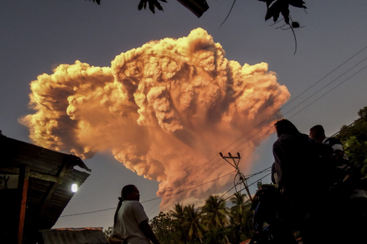
The Lembang Fault is a large fault in West Java, spanning along the northern part of Bandung, a city with 2.5 million people at least. The fault also stretches along the southern part of Mt. Tangkuban Parahu, an active volcano, said Mudrik Rahmawan Daryono, a paleoseismologist at the Indonesian Institute of Sciences (LIPI).
Even though there have been no major earthquakes lately, geomorphological evidence showed that the fault is active. Geomorphology is a science studying the form of the Earth’s surface and the process behind its formation.
“The fault is 29 kilometers long,” said Mudrik.
Researchers used data from a light detection and ranging (Lidar) tool to determine the measurement.
The fault spans from Padalarang, near Padalarang railway station, west of Bandung city and east to the Palintang area, before the hills of Manglayang mountain, east of Bandung city. Along the fault are several famous tourist destinations, including restaurants and guesthouses.
Researchers have marked each kilometer on Google Maps with a vertical line to ease further research activities and detect whether the fault is still moving.
The mapping showed that the fault had slid vertically, a phenomenon called fault scarp and looks like a long hill. In West Java, it spans Ngamprah in West Bandung regency. The movement has also distorted the path of a river nearby.
Mudrik said the river had been “beheaded”.
“It means the flow of the river was disrupted and the flow moved into another river, so the original river dried up,” he said.
The fault also caused “an anticline” or the rising of the Earth’s surface shaped like a wave, which can be seen in Karyamukti village in West Bandung regency, Mudrik went on.
Mudrik has written about this along with fellow scientists in a journal paper titled Earthquake Geology of the Lembang Fault, West Java, Indonesia. He wrote the paper with Danny H. Natawidjaja from LIPI, Benjamin Sapiie from the Bandung Institute of Technology (ITB) and Phil Cummins from the Australia National University. The scientists wrote in the paper that they had found evidence that the fault is active. The paper was published in December last year in the Tectonophysics journal.
According to the paper, research had proven that the fault had been moving for the past 11,500 years. The scientists tested the theory in Batu Lonceng village and in a former lake in Panyairan. The summary of the paper showed that the team conducted a paleoseismological trenching of the Lembang Fault and found evidence for at least three earthquakes in the past. One was in the 15th century, another was in 2,300-2,360 BCE (before common era) and the third was in 19,620-19,140 BP (before present).
“This is the first mapping of a source of crustal earthquakes in Java, Indonesia, the world’s most densely populated island in one of its most tectonically active areas. The Lembang Fault and other faults in Java are likely to pose a substantial risk to not only Bandung but many of Java’s major urban agglomerations,” the paper summarized.
Mudrik and his fellow scientists said the strong earthquakes might occur once every 170 to 670 years.
The National Disaster Mitigation Agency’s (BNPB) deputy of disaster prevention and preparedness, Wisnu Widjaja, said the BNPB would install signs along the fault in the middle of this year. Wisnu said the signs would say that the area was prone to earthquake.
At present, the areas along the fault are densely populated villages, but they also contain hotels, restaurants and a military school. The Bosscha Observatory is also near the fault.
Lembang is a favorite retreat destination for Bandung residents, Jakartans and foreign tourists. Located near Tangkuban Parahu and blessed with a cooler climate and natural beauty, the area has benefited from tourism.
But the ones who have to bear the highest risk are the villagers there, most of whom do not want to move.
Ata, 59, has not repaired the floor of his house, which sank about 50 centimeters during the earthquake eight years ago. Like Ulep and Atin, Ata said he would think about disaster mitigation later.
“If another earthquake strikes, I’ll just run,” he said lightly, remembering his flight eight years ago when he was eating a meal at home.
However, Atin hopes to receive some help from the government.
“If possible, please tell us when to run or when an earthquake strikes,” she said.


