TheJakartaPost
Please Update your browser
Your browser is out of date, and may not be compatible with our website. A list of the most popular web browsers can be found below.
Just click on the icons to get to the download page.

Popular Reads
Top Results
No results found. Please check your search term and try again
Can't find what you're looking for?
View all search resultsPopular Reads
Top Results
No results found. Please check your search term and try again
Can't find what you're looking for?
View all search resultsGoogle Earth, Google Maps update provides sharper images
Users of Google Earth and Google Maps can now view clearer and sharper images on the two apps, thanks to a shift from using the Landsat 7 to the Landsat 8 satellite.
Change text size
Gift Premium Articles
to Anyone
Share the best of The Jakarta Post with friends, family, or colleagues. As a subscriber, you can gift 3 to 5 articles each month that anyone can read—no subscription needed!
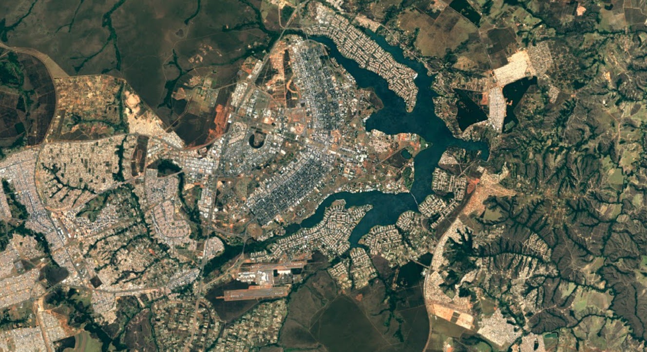 Brazil is viewed with Google Maps' new upgraded imagery. (Google Blog/-)
G
oogle has launched an update for Google Earth and Google Maps, featuring an upgrade to its satellite imagery. Now users can view clearer and sharper images on the two apps, thanks to a shift from using the Landsat 7 to the Landsat 8 satellite.
 New York City is seen in an image from the previous Landsat 7 satellite.(Google Blog/-)
 Imagery of New York from the upgraded Landsat 8 satellite is sharper and provides more detail.(Google Blog/-)

Google said on its blog that Landsat 8 was launched into orbit in 2013 and was able to capture images with greater detail, truer colors and at an unprecedented frequency, capturing twice as many images as Landsat 7 does every day.
The map is compiled from mining nearly a petabyte of Landsat imagery, or 700 trillion individual pixels, to find the best cloud-free images to use. On its blog, Google acknowledged the Landsat program and its commitment to free and accessible open data.
To see how sharp the upgrade is, open Google Earth or simply turn on the satellite layer in your Google Maps app.