Popular Reads
Top Results
Can't find what you're looking for?
View all search resultsPopular Reads
Top Results
Can't find what you're looking for?
View all search resultsAddressing disasters, density for future Jakarta
Jakarta's next spatial master plan should identify each of its five municipalities for specific functions and even out population density
Change text size
Gift Premium Articles
to Anyone
Jakarta's next spatial master plan should identify each of its five municipalities for specific functions and even out population density.
Pelita Harapan University architectural expert Manlian Ronald said Thursday the current layout had deviated much from initial plans, thus necessitating a rearrangement.
"East Jakarta used to be identified as a residential area, but now it's an industrial area. South Jakarta was also known as a residential area, but now it's full of shopping centers," he said on the sidelines of a discussion on spatial planning.
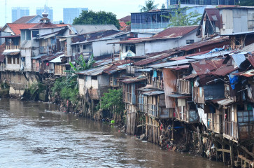
"For a better layout, there should be a clear function for each municipality, because some areas in the city have become oversaturated.
"When this happens, the excess spills over into other areas."
Better management of the existing situation is needed, since a major overhaul is not possible, he added.
The master plan, currently being drafted by the city administration to take effect in 2010, should also detail efforts to mitigate and adapt to climate change, considering the coastal capital will be heavily impacted, said Suraya Afiff, head of anthropology at the University of Indonesia.
"Spatial planning should be based on urban disaster risk management, including efforts to overcome climate change impacts," she said.
In drafting a spatial master plan, the city administration should also work with neighboring provinces on environmental management to cope with climate change, she added.
The WorldWatch Institute's 2007 State of the World, Our Urban Future report points out half the world's urban areas are in coastal zones, leaving them vulnerable to climate change impacts.
It also listed Jakarta as one of the 10 most populous cities, and warned it risked flooding and earthquakes.
It urged the importance of discussing climate change in disaster risk management and urban planning, because cities emit large amounts of CO2 and are particularly vulnerable to climate change.
Suraya said it was also crucial for Jakarta to have a continuous record on flood patterns in the city, because it contributed to the spatial plan.
"The city should also intensify preservation of coastal areas, since these areas will be most affected."
She added this included stricter management of shoreline construction. Both Manlian and Suraya agreed the city should also look to expand green areas in the new plan.
Under the 2007 Spatial Planning Law, 30 percent of the city must be allocated for green areas, with the city and all stakeholders urged to make the most of the space available, such as by creating rooftop gardens on high-rises and playgrounds in housing complexes.
- JP/Desy Nurhayati


