TheJakartaPost
Please Update your browser
Your browser is out of date, and may not be compatible with our website. A list of the most popular web browsers can be found below.
Just click on the icons to get to the download page.

Popular Reads
Top Results
No results found. Please check your search term and try again
Can't find what you're looking for?
View all search resultsPopular Reads
Top Results
No results found. Please check your search term and try again
Can't find what you're looking for?
View all search resultsMount Agung activity on the rise: Agency
Change text size
Gift Premium Articles
to Anyone
Share the best of The Jakarta Post with friends, family, or colleagues. As a subscriber, you can gift 3 to 5 articles each month that anyone can read—no subscription needed!
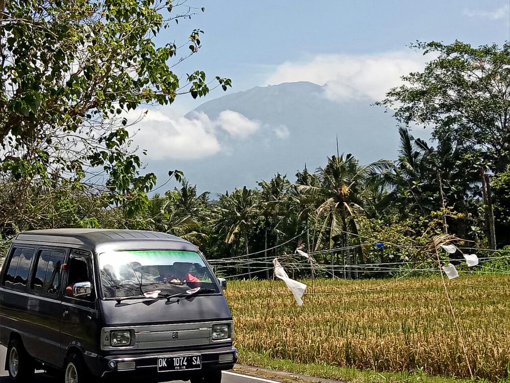 On alert: A vehicle passes a paddy field on the slope of Mount Agung in Bali recently. The alert status of the highest mountain in Bali has been increased because of its growing volcanic activity. (JP/File)
T
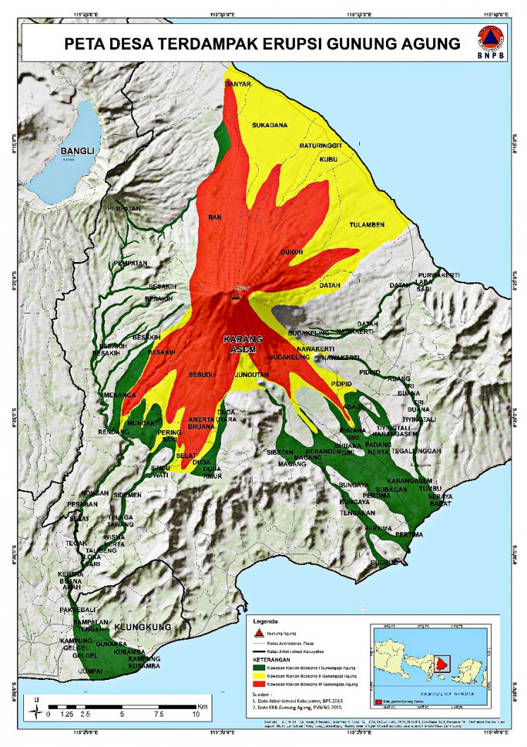
he National Disaster Mitigation Agency (BNPB) said the alert status of Mount Agung, the highest mountain in Bali, had been raised to siaga (alert level 3) following an increase in volcanic activity.
The BNPB released a written statement on Monday evening which stated that the Volcanology and Geological Disaster Mitigation Center (PVMBG) had called on the agency and the Bali Disaster Mitigation Agency (BPBD) to take preemptive measures in case of an eruption.
The PVMBG further called on people living in the areas surrounding the mountain and visitors to avoid any activity, including hiking and camping, near the crater of Mt. Agung, and all areas within a 6 kilometer radius of its peak.
“Those areas must be void of any activity,” said BNPB spokesman Sutopo Purwo Nugroho.
He asked local people and tourists in the volcano’s surrounding areas to remain calm but also warned them to stay alert.
Coordinating with the National Police and the Indonesian Military, the BNPB has conducted a series of activities to prepare people in case of an emergency.
“We have asked all people to prepare their clothes, food and valuable items in case they have to be evacuated suddenly because of an eruption," Sutopo said.
Mt. Agung’s volcanic activity has been increasing since earlier this month, indicated by a string of volcanic tremors. The volcano last erupted in 1963, during which a pyroclastic flow released from its crater damaged several villages nearby. At that time, the eruption caused around 1,100 deaths. (ebf)