TheJakartaPost
Please Update your browser
Your browser is out of date, and may not be compatible with our website. A list of the most popular web browsers can be found below.
Just click on the icons to get to the download page.

Popular Reads
Top Results
No results found. Please check your search term and try again
Can't find what you're looking for?
View all search resultsPopular Reads
Top Results
No results found. Please check your search term and try again
Can't find what you're looking for?
View all search resultsDrone captures widened crater fracture on Mt Agung
Change text size
Gift Premium Articles
to Anyone
Share the best of The Jakarta Post with friends, family, or colleagues. As a subscriber, you can gift 3 to 5 articles each month that anyone can read—no subscription needed!
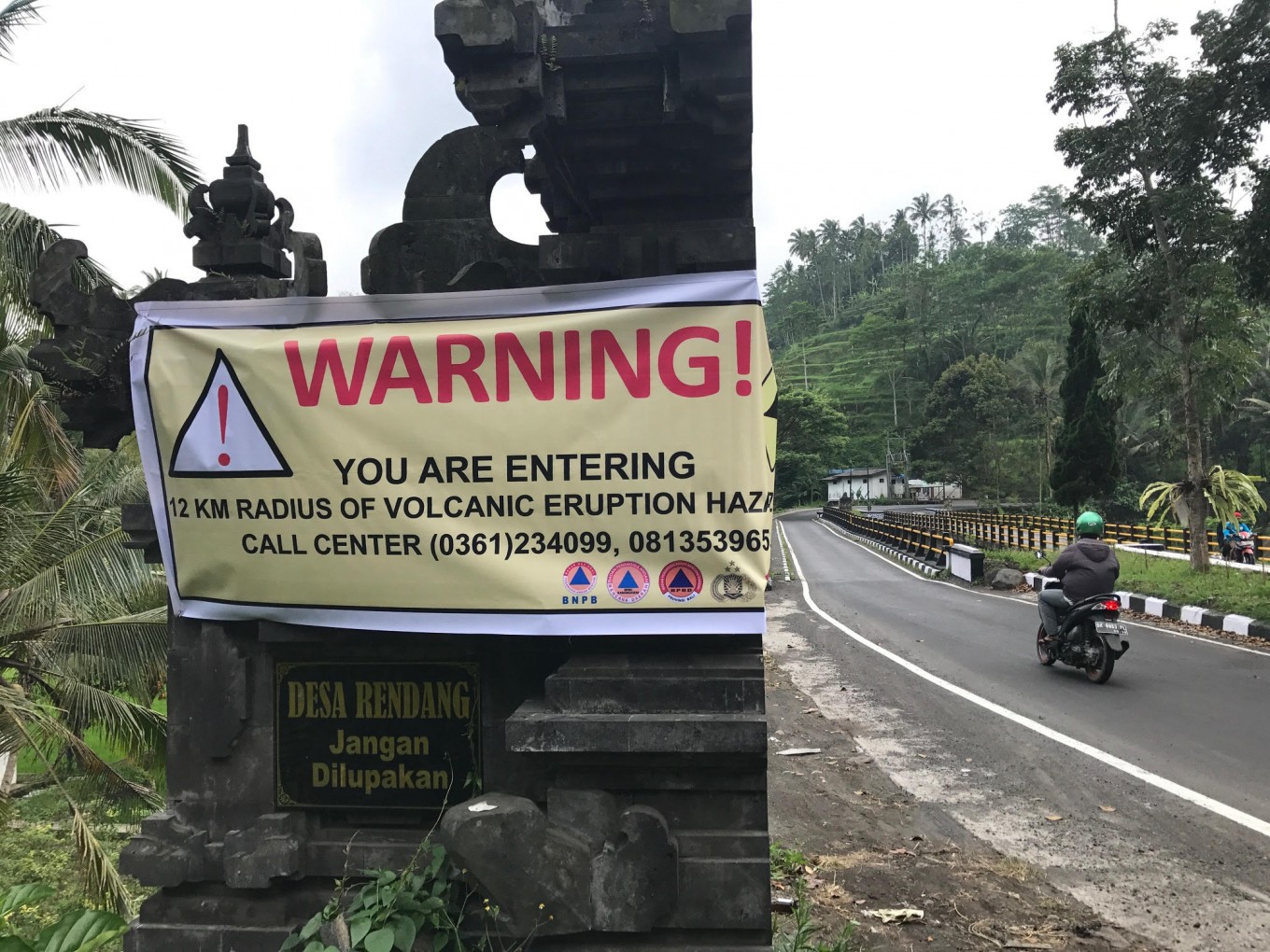 Danger zone: A banner indicates the danger zone around Mount Agung while a motorist enters the zone in on Sept. 28, a week after the volcano's alert level was raised to the highest Warning status. The mountain's volcanic activity has continued, with records showing nearly 180 tremors and a widened crater fracture as of Thursday. (JP/I Wayan Juniarta)
A
surveillance drone has detected on Thursday that the fracture in the crater of Bali's Mount Agung had widened since the last satellite imaging taken on Wednesday.
National Disaster Mitigation Agency (BNPB) spokesman Sutopo Purwo Nugroho said the fracture was located on the eastern side of the volcano.
“The sulfuric gases emanating from the fracture are also denser than before,” he said in a statement on Friday.
Sutopo added that the drone's photos also revealed a small fracture in the southeastern part of the crater.
The Bufallo FX79 drone was operated by a joint team of three personnel from the BNPB and Gadjah Mada University.
According to monitoring results of the Center for Volcanology and Geological Hazard Mitigation, Mt. Agung's volcanic activities continued on Thursday with 58 shallow volcanic tremors, 104 deep volcanic tremors and 17 local tectonic tremors. (ebf)