TheJakartaPost
Please Update your browser
Your browser is out of date, and may not be compatible with our website. A list of the most popular web browsers can be found below.
Just click on the icons to get to the download page.

Popular Reads
Top Results
No results found. Please check your search term and try again
Can't find what you're looking for?
View all search resultsPopular Reads
Top Results
No results found. Please check your search term and try again
Can't find what you're looking for?
View all search resultsNever quite ready
Change text size
Gift Premium Articles
to Anyone
Share the best of The Jakarta Post with friends, family, or colleagues. As a subscriber, you can gift 3 to 5 articles each month that anyone can read—no subscription needed!
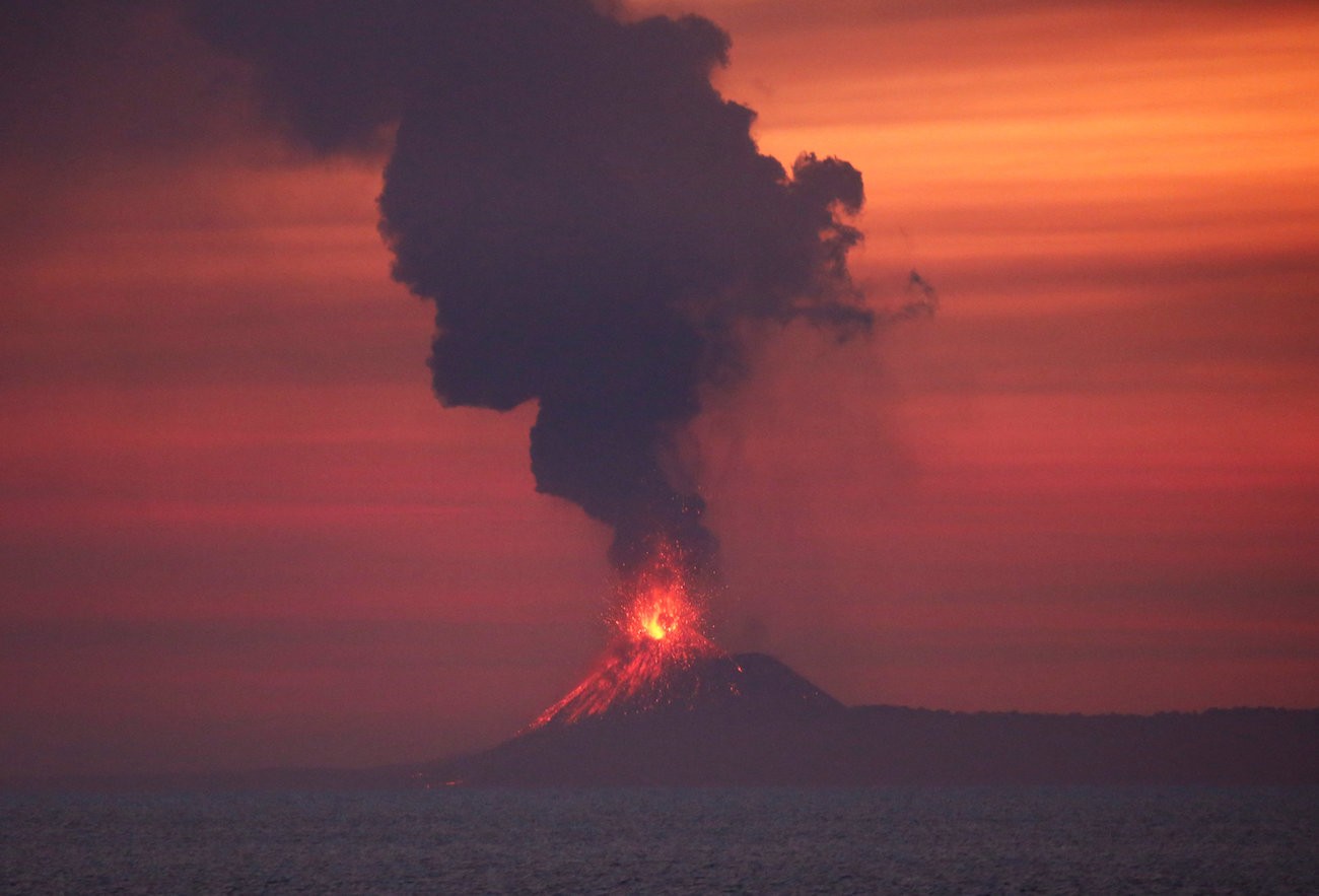 Anak Krakatau volcano is seen from Japanese helicopter carrier Kaga at the Indian Ocean, Indonesia September 22, 2018. (Reuters/Kim Kyung-Hoon)
A
head of the anniversary of the devastating Indian Ocean earthquake and tsunami that hit Aceh 14 years ago, another disaster struck Indonesia’s shores again, the third major one since the Lombok earthquake in August.
In late September, thousands died in the earthquakes, tsunami and liquefaction around Palu Bay in Central Sulawesi; and the death toll of over 400 in the tsunami in the Sunda Strait in Banten on Saturday is feared to rise. Again, the authorities seem to have been caught off guard.
Experts have said earthquakes cannot yet be predicted, but the arrival of high ocean waves can be estimated with an early warning system.
A new problem emerged with the latest tsunami, which was said to be triggered by a crater collapse of the Anak Krakatau volcano. The Meteorology, Climatology and Geophysics Agency (BMKG) stated the existing early warning system could not gauge tsunamis triggered by volcanic eruptions, the less common cause of a tsunami. The Palu disaster suggested we have even failed to make the most of the Indonesian Tsunami Early Warning System (InaTEWS) developed with international help following the Dec. 26, 2004, disaster.
Coastal residents and holidaymakers, who packed the stretch of the beach, mainly from Anyer to Tanjung Lesung during the holiday season, did not see or hear the high waves until they hit the area, resulting in over 400 deaths, with at least 1,000 injured and scores still missing. “We didn’t feel any earthquake,” said a survivor who was still searching for news of his baby.
Indonesia faces the same question again and again: How can we be ready for multiple and often complex forms of natural disasters?
Those living far from volcanoes and oceans may say people should move somewhere else. But the millions living in the Pacific Ring of Fire, where the major Krakatau eruption in 1883 took place, the ashes of which kept the world in the dark and altered weather patterns for a year, have little choice but to live with the risks. Yet, we should be much more prepared.
The fusion of a volcanic eruption leading to a tsunami in the Sunda Strait showed that better technology is urgently needed to analyze studies of varied, complex natural phenomena. With Anak Krakatau said to have erupted almost daily since the end of June, it is unclear how far scientists secured their repeated requests for funding to support research for much better preparedness, to save more lives.
As it stands, the government has been very reliant on data provided by foreign satellites to study natural disasters and other geographical phenomena. It has yet to have a satellite dedicated to observe and mitigate natural disasters.
Anak Krakatau, a volcano island that emerged after Krakatau’s destruction, ascends 4 to 6 meters annually. It still heavily spews volcanich ash, raising concerns that the worst is yet to come.
The government must prioritize studies on the risks of the volcano while ensuring residents and frequent visitors to the Sunda Strait remain on the alert. Meanwhile, support for research and better preparedness for other disasters across the country is also urgently needed.