TheJakartaPost
Please Update your browser
Your browser is out of date, and may not be compatible with our website. A list of the most popular web browsers can be found below.
Just click on the icons to get to the download page.

Popular Reads
Top Results
No results found. Please check your search term and try again
Can't find what you're looking for?
View all search resultsPopular Reads
Top Results
No results found. Please check your search term and try again
Can't find what you're looking for?
View all search resultsWreck of Tunu Pratama Jaya ferry found upside down in Bali Strait
Change text size
Gift Premium Articles
to Anyone
Share the best of The Jakarta Post with friends, family, or colleagues. As a subscriber, you can gift 3 to 5 articles each month that anyone can read—no subscription needed!
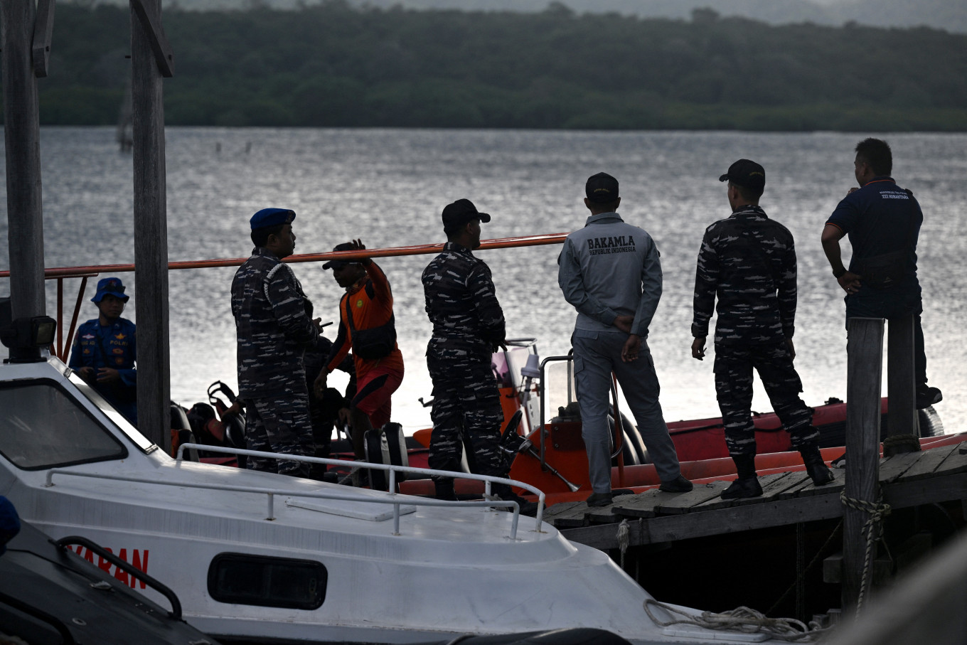 Rescuers search for missing victims of a ferry accident in the waters off the Bali Strait near Jembrana, Bali Island, on July 5. Hundreds of Indonesian rescuers widened their search for dozens of missing people on July 4, after a ferry sank in rough seas on the way to the resort island of Bali, with six bodies recovered. (AFP/Sonny Tumbelaka)
T
he joint search and rescue (SAR) team has finally located the wreck of the KMP Tunu Pratama Jaya ferry on the seabed of the Bali Strait using an underwater drone, following its sinking just before midnight on July 2.
Second Fleet Sea Combat Task Force (Guspurla) commander Cdre. Endra Hartono confirmed that the vessel was found upside down during a monitoring operation on Saturday. The discovery came after four underwater search attempts, hindered by strong currents in the strait.
The wreck was located approximately 3.9 kilometers from the site of the accident by a drone operated by the Indonesian Navy’s (TNI-AL) hydro-oceanographic support vessel, KRI Spica.
“We identified the vessel by its name and the lower structure, which matched that of KMP Tunu Pratama Jaya” Endra said on Sunday.
Authorities are now considering a salvage operation, as the SAR team is preparing a diving mission and is coordinating with the Meteorology, Climatology and Geophysics Agency (BMKG) to determine a safe diving location.
Meanwhile, the Navigation District from Tanjung Perak deployed a special team to mark the exact location of the sunken ferry, KompasTV reported.

Read also: Ongoing KNKT probe suggests human error in Tunu Pratama Jaya's sinking