TheJakartaPost
Please Update your browser
Your browser is out of date, and may not be compatible with our website. A list of the most popular web browsers can be found below.
Just click on the icons to get to the download page.

Popular Reads
Top Results
No results found. Please check your search term and try again
Can't find what you're looking for?
View all search resultsPopular Reads
Top Results
No results found. Please check your search term and try again
Can't find what you're looking for?
View all search resultsBali to map out flood areas
The Bali provincial administration will be mapping flood-prone areas on the island in response to the recent flood disaster on Jan
Change text size
Gift Premium Articles
to Anyone
Share the best of The Jakarta Post with friends, family, or colleagues. As a subscriber, you can gift 3 to 5 articles each month that anyone can read—no subscription needed!

The Bali provincial administration will be mapping flood-prone areas on the island in response
to the recent flood disaster on Jan.11, 2009.
Bali Social Services Agency head Nyoman Puasha Aryana said the mapping, which was scheduled to be finished in the middle of the year, would help the government deliver assistance to flood victims and prevent further flooding.
“We’ll map out areas that are flood-prone and places that are close to hospitals and can be used as evacuation sites,” Puasha said during a meeting on disaster response at the governor’s office Thursday.
“This way, we can better coordinate our response.”
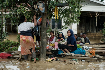
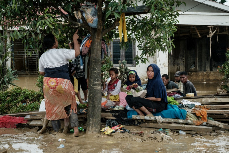
Two weeks ago, much of south Bali’s densely populated areas –including Denpasar, Kuta and Seminyak – were hit by flash floods after heavy, overnight rainfall.
It was the worst flood to hit Bali within the past decade, forcing dozens of families to evacuate their homes as floodwater reached chest level in some areas.
Puasha stressed the importance of the map, predicting that Bali may have more floods in the years to come.
He said the social services agency was prepared to deal with floods in the future, saying there were enough food supplies to help flood victims.
“Flooding might occur within the next two to three months.
We are still ready to coordinate with the other agencies within the government’s disaster response team,” he said.
The Bali Climatology, Meteorological and Geophysics Agency (BKMG) warned flooding might still occur up until early March.
Head of the services division of the BKMG, Nyoman Suarsa, said January and February remained the months most in which flooding might occur.
He said the rainfall, which caused Bali to flood last week reached 189 millimeters per day, with wind speeds surpassing 30 kilometers per hour.
Rain intensity in Bali normally stays under 115 millimeters per day range.
“This means the rain intensity in Bali seems to be getting higher and higher compared to previous years,” Suarsa said.
“We think this sort of rain intensity will remain for the next couple of months.”