TheJakartaPost
Please Update your browser
Your browser is out of date, and may not be compatible with our website. A list of the most popular web browsers can be found below.
Just click on the icons to get to the download page.

Popular Reads
Top Results
No results found. Please check your search term and try again
Can't find what you're looking for?
View all search resultsPopular Reads
Top Results
No results found. Please check your search term and try again
Can't find what you're looking for?
View all search resultsCentral Sulawesi jolted by 30 quakes daily
The numerous daily quakes are caused by shifts in the Palukoro fault.
Change text size
Gift Premium Articles
to Anyone
Share the best of The Jakarta Post with friends, family, or colleagues. As a subscriber, you can gift 3 to 5 articles each month that anyone can read—no subscription needed!
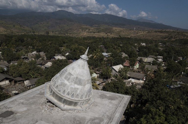 This aerial photo shows a collapsed mosque in the village of Sugian on Indonesia's Lombok Island on Aug. 21 after a series of recent earthquakes. (AFP/Fred Dufour)
T
he Palu Meteorological, Climatology and Geophysics Agency (BMKG) in Central Sulawesi says the region has been rocked by around 30 earthquakes daily over the last four months.
The numerous daily quakes are caused by shifts in the Palukoro fault, which extends from Poso to the waters of Tolitoli regency and branches off to the Matano fault in South Sulawesi.
"The magnitudes of the tremors vary. Some were undetectable while others could be felt by in the region," Cahyo Nugraha, head of the BMKG’s geophysics department, told The Jakarta Post on Wednesday.
A 5.2-magnitude earthquake destroyed houses, churches, mosques and schools in North Lore district, Poso, Central Sulawesi, last year.
Tadulako University seismologist Abdullah said because it sat on top of one of the most active faults in the country, Palu in Central Sulawesi was considered to be among areas that were most prone to earthquakes and tsunamis in eastern Indonesia.
The first tsunami in the area was recorded in 1927 when a 15-meter wave slammed into the city, killing 15 people and injuring 50.
A 1938 tsunami killed 16 people and destroyed piers and a lighthouse on the Parigi shore, while another tsunami in the city of Tambu in 1968 followed a 6.0-magnitude quake. (ris)