TheJakartaPost
Please Update your browser
Your browser is out of date, and may not be compatible with our website. A list of the most popular web browsers can be found below.
Just click on the icons to get to the download page.

Popular Reads
Top Results
No results found. Please check your search term and try again
Can't find what you're looking for?
View all search resultsPopular Reads
Top Results
No results found. Please check your search term and try again
Can't find what you're looking for?
View all search resultsGerman geoscience center detected 5.1 M quake before Sunda Strait tsunami
Neither the BMKG nor the USGS detected the earthquake in the Sunda Strait.
Change text size
Gift Premium Articles
to Anyone
Share the best of The Jakarta Post with friends, family, or colleagues. As a subscriber, you can gift 3 to 5 articles each month that anyone can read—no subscription needed!
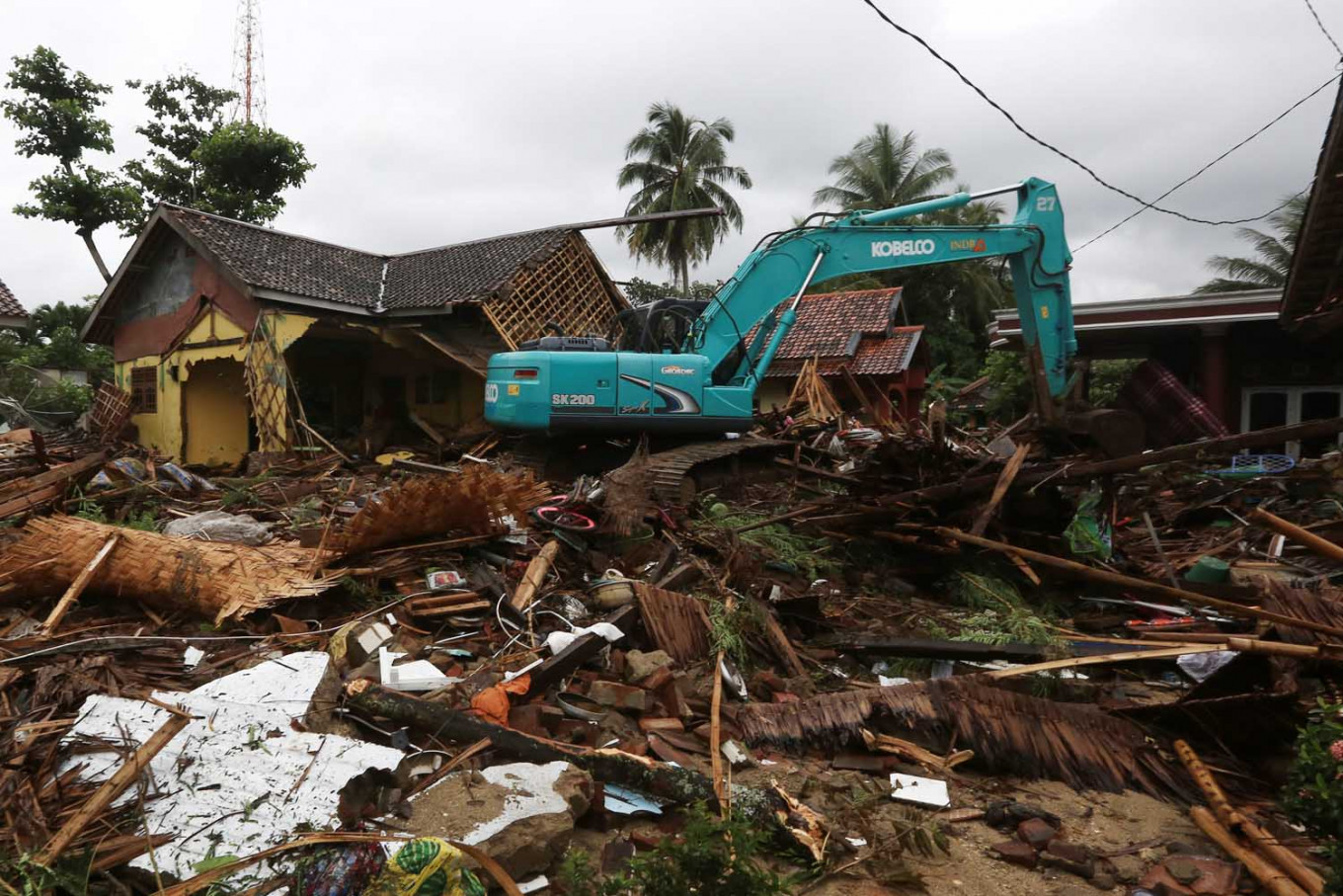 A backhoe clears the debris caused by the tsunami on Carita Beach in Pandeglang, Banten on Sunday. (JP/Dhoni Setiawan)
A
n earthquake that occurred near the Anak Krakatau volcano on Saturday night may have contributed to the tsunami that hit beaches in Banten and Lampung shortly afterward.
The German Research Center for Geosciences (GFZ) detected a 5.1-magnitude earthquake around 25 kilometers east of Anak Krakatau at 8:55 p.m. local time on Saturday.
The Meteorology, Climatology and Geophysics Agency (BMKG) detected an eruption from the volcano at 9:03 p.m. and tide gauge stations in Banten and Lampung detected a tsunami between 9:27 PM and 9:53 p.m.
A GFZ article from last Tuesday said there was evidence that large earthquakes could either trigger or inhibit volcanic activity.A widely circulated release from the Volcanology and Geological Disaster Mitigation Center (PVMBG) said the earthquake may have amplified the eruption of Anak Krakatau.
"The earthquake also disturbed the stability of the body of the volcano at the south and southwest which resulted in a partial collapse of the volcano's body and triggered a tsunami," the statement said. "The earthquake, the landslide, and the tsunami occurred within a very short period of around 36 minutes."
PVMBG later sent another release, but the part about the earthquake was deleted.
PVMBG head Kasbani said the center's team was still in the field investigating the cause of the tsunami and that no conclusion had been reached yet.
The BMKG had said in a statement on Saturday night that it had detected no tectonic earthquake in the area during the time of the tsunami and that it suspected that seismic activity from Anak Krakatau caused a landslide that triggered the tsunami.
The United States Geological Survey (USGS) also did not detect any earthquake in the Sunda Strait on Saturday night.
On Dec. 22, a professor of geology and volcanologist at Michigan Technological University, Simon Carn, tweeted at @simoncarn, showing a time lapse made from satellite images of Anak Krakatau. Carn said the volcano had been growing since May 2018. The next day, he posted comparison images that show the growth.
Growth of Anak #Krakatau #volcano since May 2018 from @planetlabs imagery. Fairly rapid recent expansion to the south could possibly have caused some flank instability. Still awaiting post-#tsunami imagery to assess any changes. @Sutopo_PN @vulkanologi_mbg @id_magma pic.twitter.com/ETLqo68Awf
— Simon Carn (@simoncarn) December 23, 2018
Comparison of @planetlabs images of south flank of #Krakatau #volcano on May 22 and Dec 17, 2018.https://t.co/C5v4EPK59l pic.twitter.com/cCcAN0yMw6
— Simon Carn (@simoncarn) December 23, 2018
Earlier, National Disaster Mitigation Agency spokesperson Sutopo Purwo Nugroho said the country only had an early warning system for tsunamis triggered by earthquakes. (evi)