TheJakartaPost
Please Update your browser
Your browser is out of date, and may not be compatible with our website. A list of the most popular web browsers can be found below.
Just click on the icons to get to the download page.

Popular Reads
Top Results
No results found. Please check your search term and try again
Can't find what you're looking for?
View all search resultsPopular Reads
Top Results
No results found. Please check your search term and try again
Can't find what you're looking for?
View all search resultsConcerns of transparency, inclusivity raised as One Map nears completion
Indonesia’s highly-anticipated One Map Policy is inching toward completion, but observers are wary of the project’s lack of transparency and inclusiveness and whether the rights of indigenous communities are honored.
Change text size
Gift Premium Articles
to Anyone
Share the best of The Jakarta Post with friends, family, or colleagues. As a subscriber, you can gift 3 to 5 articles each month that anyone can read—no subscription needed!
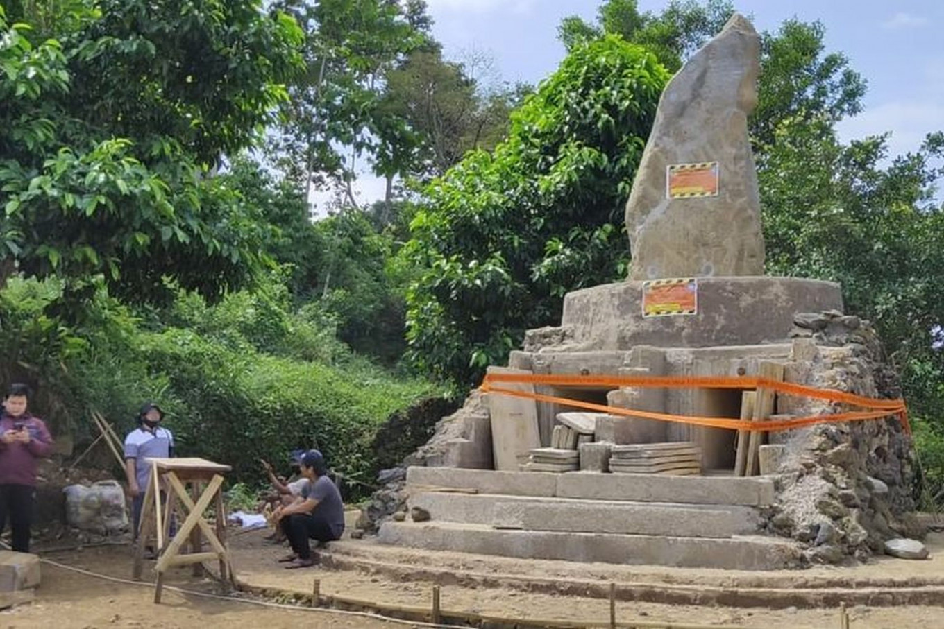 Local authorities seal a construction site claimed as a "tomb" for elders of the indigenous Sunda Wiwitan faith group in Cisantana village in West Java's Kuningan regency on July 21. Authorities said the monument had been closed off because of the indigenous group's failure to produce a building permit. (Kompas.com/Muhamad Syahri Romdhon)
Indonesia’s highly-anticipated One Map Policy is inching toward completion with most datasets successfully compiled by the government, but observers are wary of the project’s lack of transparency and inclusiveness and whether the rights of indigenous communities are honored.
Initiated in 2011 by then-president Soesilo Bambang Yudhoyono and continued by President Joko “Jokowi” Widodo, the integrated data map is expected to address overlapping land disputes that have emerged out of the previously disparate mapping methods of various state institutions.
The policy aims to produce a map with a geoportal database of 85 thematic maps of the 34 provinces that are provided by 19 ministries and government agencies.
Dodi Slamet Riyadi, the undersecretary for spatial planning and strategic economic zones at the Office of the Coordinating Economic Minister, said the project was close to completion as all thematic maps had been compiled and the integration and synchronization processes were underway across the nation.
Back in February, President Jokowi said the government aimed to finish the One Map by December 2020. Since then, however, authorities have found that some 40 percent of the nation’s landmass – equal to 77,365,141 hectares – were disputed.
According to official data, about 9.3 percent of the land is claimed by provincial and city/regency-level spatial plans, 10.6 percent is subject to dispute among spatial plans and designated forest area, another 16.1 percent is subject to permit or ownership disputes between spatial plans and forest area, while 4.6 percent overlaps with all three area types.
The Executive Office of the President has received up to 855 reports of agrarian conflict between May 2016 and July 2020. Officials there have processed 133 cases, 94 percent of which have to do with plantations.
“The root of the problem is overlapping land claims,” Dodi said during an online discussion on Tuesday.
Despite its large and ambitious scope of work, the One Map Policy process has been largely closed off from the public, with datasets mainly provided by government institutions.
Critics say this has led to the exclusion of indigenous communities, who otherwise exist beyond the boundaries of government-led spatial planning.
The One Map Policy geoportal (http://portal.ina-sdi.or.id/) is also only fully accessible to the president and vice president, the coordinating economic minister, the agrarian and spatial planning minister and the head of the Geospatial Information Agency (BIG) as well as select ministers and representatives of government institutions, governors, mayors and regents.
A “participatory” map initiated by the Indonesian Community Mapping Network (JKPP), which covers at least 14 million ha across 27 provinces, has offered ideas to account for customary land distribution.
JKPP advocacy division head Imam Hanafi said the current dataset recognized in the One Map Policy had yet to properly recognize the rights of indigenous communities on customary land.
The government currently only recognizes customary forests, data for which is provided by local environment and forestry agencies, as well as communal rights to customary land, which is recognized through the Agrarian and Spatial Planning Ministry and National Land Agency.
Even then, such “communal land” is recognized only as a non-forest area that is individually registered, also known as “areas for other use” (APL).
“In reality, customary land does not only equate to customary forests. Every indigenous community has its own cultural [underpinnings in the surrounding land and forest],” Imam said.
Based on its mapping efforts, the network proposes that the One Map Policy recognize at least 128,745 ha of customary forests, 113,972 ha of social forests, 112,245 ha of land subject to agrarian reform and 11,116,450 ha of “customary regions” – which may include various types of customary land.
On top of that, the JKPP found 470 instances of tenurial conflict, of which 168 are in Kalimantan. Around 50 percent of these have to do with plantations.
Imam is hopeful that the results of the JKPP’s participatory mapping could be included in the One Map Policy dataset, and that the public may get access to the geoportal.
In response, Dodi said the government had been open to suggestions for its integrated map and was willing to include indigenous groups’ rights and ownership in the One Map.
However, he also said the state was bound by prevailing regulations requiring all data references to have a government agency as a custodian.
“If the participatory map wants to be included, it must be decided who the data custodian would be,” he said.
Greenpeace Indonesia’s forest campaigner, Arie Rompas, argued that data used in the One Map Policy came from the public domain anyway, and that any attempt to withhold it could violate Law No. 14/2008 on public information.
“It will not address inequality [in the agrarian sector], if control lies solely with the government,” Arie said.
He said the government had previously been found guilty of withholding public domain information, as was the case for data on the right to cultivate (HGU), even in spite of 12 different verdicts in favor of releasing HGU data to the public.
These include decrees by the East Kalimantan Public Information Commission (KIP), the West Kalimantan KIP and the Papua KIP as well as state administrative court rulings and even one from the Supreme Court.
“The government must strengthen the One Map Policy, open it up to public access and comply with court orders to publish the HGU data,” Arie said.