New spatial master plan to focus on public transport
The city administration is discussing a draft on a spatial master plan for next year that will focus on the development of public transportation by building interconnections between means of transport
Change Size

The city administration is discussing a draft on a spatial master plan for next year that will focus on the development of public transportation by building interconnections between means of transport.
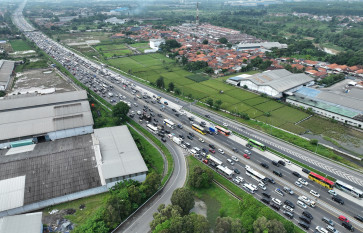
Head of the city’s development agency Nurfakih Wirawan told reporters Monday the new plan would be public-transportation-oriented, in order to address the capital’s chronic traffic jams.
“Transportation will be a decisive factor to build the city in the future, as we aim to develop the Mass Rapid Transit [MRT] network and improve the existing railway system, so that all transportation networks will be interconnected.”
He said the administration would bring the master plan to the BKTRN [National Spatial Planning Agency], which would later be discussed with the central government.
“We will finalize the master plan based on the outcome of the discussion and propose it to the city council during the next tenure.”
He said the administration had also discussed the master plan with two surrounding provinces, Banten and West Java.
Governor Fauzi Bowo previously said the construction of the MRT would be a major change to the city’s spatial planning, due to the advent of an underground network.
The MRT construction starting between March and April next year, will include 12 stations along the Lebak Bulus-Dukuh Atas route.
The route will start at Lebak Bulus and pass through Jl. Fatmawati, Jl. Cipete Raya, Jl. Haji Nawi, Blok A, Blok M, Jl. Sisingamangaraja and Senayan. The route will continue through the underground stations in Istora, Bendungan Hilir, Setiabudi, and end at Dukuh Atas.
After the Lebak Bulus-Dukuh Atas, the city administration will also build another route connecting Dukuh Atas to Kota in West Jakarta.
Among the supporting facilities on MRT network are park-and-ride and dropping off points, elevated and underground bicycle lanes, cafés and small shops.
Environment activists have also asked the city administration to accommodate more green spaces in the next year’s spatial master plan.
The administration is targeting to allocate only 13.9 percent of the city for green spaces in the new master plan, lower than the minimum 30 percent as regulated in the 2007 Law on Spatial Planning.
The law stipulates the proportion of green spaces in a city should be at least 30 percent of the total area, 20 percent of which should be public green spaces.
The Park and Cemetery Agency maintained it would be difficult to provide as much as 30 percent, citing most of the city’s land structure made it possible for dwellers to build homes, moreover with the influx of people from rural areas.
The agency has so far managed to allocate 9.7 percent out of the 13.9 percent targeted until 2010.
It said that the remaining 4.2 percent would only be available by the end of this year, due to technical problems in taking over the land.
By the end of this year, the city is targeting 20 hectares of green spaces.

