TheJakartaPost
Please Update your browser
Your browser is out of date, and may not be compatible with our website. A list of the most popular web browsers can be found below.
Just click on the icons to get to the download page.

Popular Reads
Top Results
No results found. Please check your search term and try again
Can't find what you're looking for?
View all search resultsPopular Reads
Top Results
No results found. Please check your search term and try again
Can't find what you're looking for?
View all search resultsMapping, risk-reduction programs needed: Researchers
Researchers say there is a need for topography mapping and risk-reduction programs to avoid high victim counts during natural disasters
Change text size
Gift Premium Articles
to Anyone
Share the best of The Jakarta Post with friends, family, or colleagues. As a subscriber, you can gift 3 to 5 articles each month that anyone can read—no subscription needed!

R
esearchers say there is a need for topography mapping and risk-reduction programs to avoid high victim counts during natural disasters.
Researcher Nugroho Dwi Hananto of the Indonesian Institute of Sciences (LIPI) said the government could prepare for the impact of tsunami-triggering earthquakes should it have a map of the sea basin, especially in the southern part of Java Island, the country's most populated region.
Nugroho, who is also head of LIPI's cooperation and dissemination subdivision, said that such mapping was needed in the southern parts of Java Island to assess which areas had the potential of experiencing a tsunami.
'This could help mitigation efforts as the research is based on data directly collected from the site and not from a satellite or land station,' Nugroho, who has been researching sea basin earthquakes, said on Monday.
Topographic mapping, according to Nugroho, could be carried out in shallow areas where the ocean and continental plates met. Such mapping, he said, had been conducted by private companies working in the oil and gas field.
The research would need Rp 50 billion (US$3.8 million) for equipment and Rp 300 million per day for the operation of the ship, he said.
'This is nothing compared to the lives and assets that can be saved in a time of disaster,' Nugroho said.
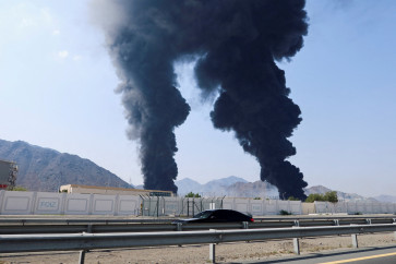
Limited data on the condition of the surface of the sea basin, according to Nugroho, made it difficult for researchers to determine the cause of the earthquake that triggered a tsunami on Pangandaran Beach, Ciamis regency, West Java, in 2006, which claimed more than 400 lives.
Meanwhile, the Surabaya-based 10 November Institute of Technology (ITS)'s Center for the Study of Earth Disasters and Climate Change (PSKBPI) head, Amien Widodo, said that victim counts in disasters remained high due to a lack of government-initiated strategic disaster risk-reduction programs.
Amien said risks could be mitigated as more than 90 percent of the disasters in Indonesia from 1815 to 2014 were related to the weather, or recurrent annual disasters, while the rest were quakes and tsunamis, eruptions, pest attacks and traffic accidents.
'Only few people are really unaware of disasters that are looming around them. Most of them do not want to know. For instance, many people clear the forest to build buildings despite knowing that it could cause floods and landslides,' he said recently.
Amien, who recently launched two books on disasters titled Manajemen Bencana (Disaster Management) and Mitigasi dan Adaptasi Perubahan Iklim (Mitigation and Adaptation of Climate Change), said recurrent disasters in Indonesia included floods, landslides, drought, whirlwinds, high tides and erosion.
The climate-related disasters, according to Amien, who is also geologist at ITS, should be foreseen earlier, suggesting the government and the community change the paradigm of disaster mitigation from responsive action to preventive programs.