TheJakartaPost
Please Update your browser
Your browser is out of date, and may not be compatible with our website. A list of the most popular web browsers can be found below.
Just click on the icons to get to the download page.

Popular Reads
Top Results
No results found. Please check your search term and try again
Can't find what you're looking for?
View all search resultsPopular Reads
Top Results
No results found. Please check your search term and try again
Can't find what you're looking for?
View all search results'Smart City' development requires Detailed Spatial Plan: Ministry official
Change text size
Gift Premium Articles
to Anyone
Share the best of The Jakarta Post with friends, family, or colleagues. As a subscriber, you can gift 3 to 5 articles each month that anyone can read—no subscription needed!
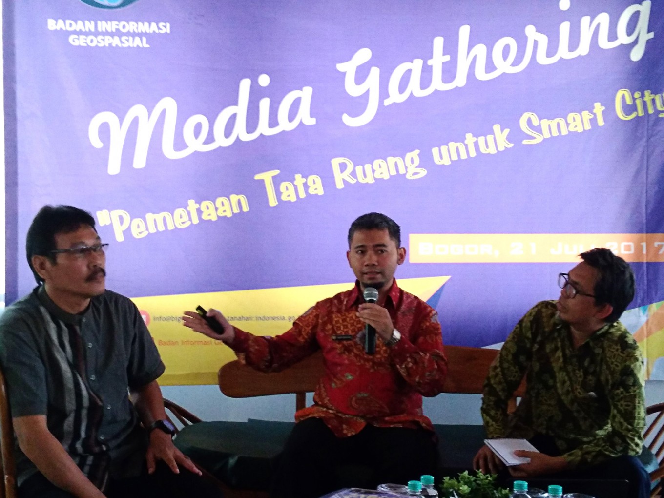 For a better city: An official with the Agrarian and Spatial Planning Ministry’s spatial planning directorate general, Andri Hari Rochayanto (center), explains the Smart City concept at a recent discussion in Bogor, West Java. (JP/Theresia Sufa)
T
he Bogor administration is striving to turn the West Java city into a "Smart City", although it has yet to develop a Detailed Spatial Plan (RDTR), which is an important spatial planning and zoning tool, a ministry official has said.
An official with the Agrarian and Spatial Planning Ministry’s directorate general for spatial planning, Andri Hari Rochayanto, said Bogor was one of the few cities that had promoted the “Smart City” concept. However, the concept mostly concerned the local government's online system, not spatial planning.
“It would be better if, during the revision of its master spatial plan [RTRW], the Bogor administration could also develop an RDTR,” Andri said during a discussion on spatial planning held by the Geospatial Information Agency in Bogor recently.
He said the RDTR concerned the livelihood of city residents, so its development needed to involve all elements of society.
Andri said the central component of a Smart City was its sustainability principle. Unfortunately, only 20 out of 122 cities and municipalities across Java and Bali had developed a related detailed plan. “This problem occurs because local administrations are more interested in revising their RTRWs than in developing an RTDR,” he said.
The head of the Geospatial Information Agency's research, promotion and cooperation center, Wiwin Ambarwulan, said several Indonesian cities – such as Balikpapan in East Kalimantan, Bandung (West Java), Jakarta, Makassar (South Sulawesi) and Surabaya (East Java) – had established the Smart City concept, through which the local administrations helped their residents to manage resources efficiently.
They also provided detailed information to people and institutions in carrying out the plan, Wiwin said. “Still, the development of a Smart City must be supported by an accurate spatial planning.” (ebf)