TheJakartaPost
Please Update your browser
Your browser is out of date, and may not be compatible with our website. A list of the most popular web browsers can be found below.
Just click on the icons to get to the download page.

Popular Reads
Top Results
No results found. Please check your search term and try again
Can't find what you're looking for?
View all search resultsPopular Reads
Top Results
No results found. Please check your search term and try again
Can't find what you're looking for?
View all search resultsUnderstanding China around Natuna and how Indonesia should respond
When Indonesia and China use UNCLOS to claim their maritime zones/entitlements, it is clear that there are no overlapping maritime areas.
Change text size
Gift Premium Articles
to Anyone
Share the best of The Jakarta Post with friends, family, or colleagues. As a subscriber, you can gift 3 to 5 articles each month that anyone can read—no subscription needed!
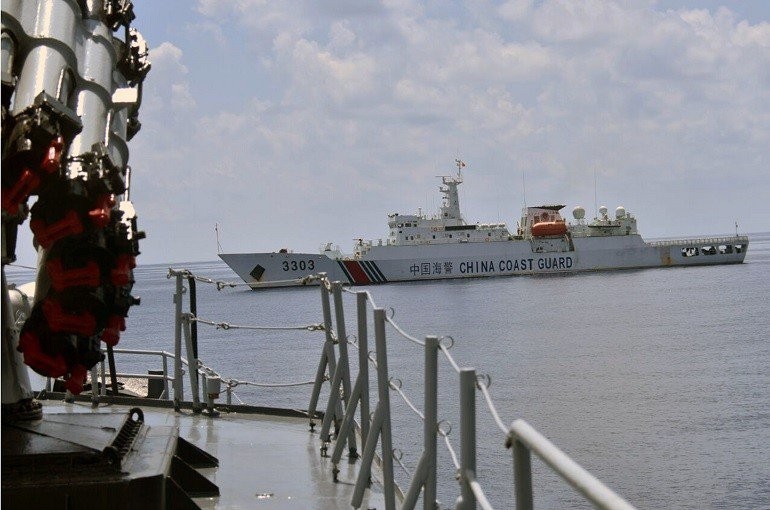 Chinese coast guard ship 3303 passes Imam Bonjol warship 383 as the Indonesian Navy pursues the Han Tan Cou fishing vessel entering Indonesia's Natuna waters on June 17. The Navy caught the China-flagged boat suspected of illegal fishing in Indonesian waters. (Antara/Photo Courtesy of The Navy's Western Region Fleet Command (Koarmabar))
R
euters (Dec. 1) reported that China had told Indonesia to stop drilling for oil and natural resources in the maritime areas close to Natuna Islands, Riau Islands province. Apparently, both countries are sure that the concerned maritime areas fall within their respective jurisdiction.
Let us understand why and how Indonesia and China seem to have overlapping maritime areas around Natuna Islands. Both countries have ratified the United Nations Convention on the Law of the Sea (UNCLOS), the most widely accepted global regulation regarding ocean affairs and the law of the sea. UNCLOS is known as “the Constitution of the Ocean”. Hence, it is fair to start from provisions in UNCLOS to evaluate the legal position of Indonesia and China.
Every coastal state is entitled to maritime spaces/zones measured from its baselines/coastlines. Such zones are territorial seas (12 nautical miles), contiguous zones (24 NM), exclusive economic zones or EEZ (200 NM) and continental shelves or seabed that may extend beyond 200 NM. In accordance with UNCLOS provisions, a coastal state is entitled to large maritime areas and such entitlements can easily cause overlapping areas between neighboring countries when the distance between them is close enough.
When two countries have overlapping maritime areas, they will need to delimit maritime boundaries between them. It can be for territorial seas, an EEZ or continental shelf depending on the distance between them.
What about China and Indonesia? Robust measurements of maritime zones from baselines of both countries do not show any overlap. EEZ claims of 200 NM from the southern tip of China and the northern tip of Natuna in Indonesia do not cause any overlap, as the distance between the two is far enough. Legally speaking, Indonesia and China are not neighbors and they do not need to delimit maritime boundaries.
If any, Indonesia has overlapping maritime zones with Malaysia and Vietnam for both continental shelves (seabed) and EEZs (water column). In 1969, Indonesia and Malaysia agreed upon a continental shelf boundary between them. It was followed by another seabed boundary segment agreed upon by Indonesia and Vietnam in 2003.

These two agreements create boundary lines that enclose Indonesia’s seabed. Therefore, Indonesia’s seabed, where oil and gas exploration and exploitation may take place, has been made clear. No parties have expressed their rejection or protest to the arrangement. It came as a surprise, therefore, when China told Indonesia to stop drilling for oil and natural gas in the seabed.