TheJakartaPost
Please Update your browser
Your browser is out of date, and may not be compatible with our website. A list of the most popular web browsers can be found below.
Just click on the icons to get to the download page.

Popular Reads
Top Results
No results found. Please check your search term and try again
Can't find what you're looking for?
View all search resultsPopular Reads
Top Results
No results found. Please check your search term and try again
Can't find what you're looking for?
View all search resultsGovt regulates naming of geographical features to preserve history
The new regulation enables coordination across government agencies and ministries in renaming a wide variety of geographical features, from natural landmarks to man-made features and monuments.
Change text size
Gift Premium Articles
to Anyone
Share the best of The Jakarta Post with friends, family, or colleagues. As a subscriber, you can gift 3 to 5 articles each month that anyone can read—no subscription needed!
A
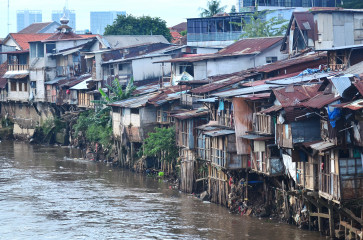
recently issued regulation will allow for the renaming of Indonesian natural landmarks and man-made features in a bid to preserve the nation’s history, traditions and cultural heritage, as well as maintaining sovereignty and territorial integrity.
Under Government Regulation (PP) No. 2/2021 on the application of topographic names, the state is now able to coordinate name changes with geographical features such as islands, mountains, seas, rivers and lakes, as well as underwater features and public monuments. President Joko “Jokowi” Widodo signed the regulation on Jan. 6.
Features under review would be renamed either in the Indonesian language or in an indigenous or foreign language, depending on their historical significance. This task is given to the Geospatial Information Agency (BIG), in coordination with relevant ministries and state agencies.
The regulation assumes the importance of inserting topographic names or toponyms onto maps of Indonesia to ensure national security and sovereignty are preserved.
“Names are closely linked to a nation’s core [existence], as they carry [within them] identity, sovereignty, independence, culture and so forth,” said the head of BIG’s Topography Mapping and Toponym Center, Ade Komara Mulyana, in a statement to The Jakarta Post on Thursday.
As such, Ade said it was important that the government ensured consistency and accuracy in providing toponyms for natural, cultural and even man-made features.
The official said that it was part of the government’s efforts to improve the quality and efficiency of geographical names, in accordance with recommendations from the United Nations Group of Experts on Geographical Names.
Read also: Great Mosque of Palembang unveils new name
Among the landmarks that are up for review is Lawuloi Lake in South Sulawesi, which might be recategorized as a reservoir, and Lombok International Airport, which could be renamed Zainudin Abdul Majid (Bizam) International Airport, based on a 2018 Transportation Minister decree.
Toponyms that have received approval from a board of final arbiters will be gazetted and circulated internationally through the UNGEGN forum.
Acting as the national naming authority (NNA), BIG must coordinate with relevant ministries and institutions and join international meetings facilitated by the Foreign Ministry, according to a BIG press statement on Thursday.
Indonesia’s gazette for geographical names is to be managed under the One Map Policy and made publicly accessible.
In addition to providing general guidelines for renaming or recategorizing a geographical feature, the regulation also forbids the use of names of living persons or institutions so as to prevent any conflict of interest.
Previously, any revision of geographical names was handled by the national team for the standardization of toponyms (Timnas PNR), which was set up in 2006. The team consisted of the home minister, the foreign minister, the maritime affairs and fisheries minister, the education minister and BIG.
A decade later, the team was disbanded and all tasks handed over to BIG.
“However, the application of geographical names cannot be the sole responsibility of BIG. We needed to set up a way to coordinate with regional governments and ministries,” Ade said.
For instance, the Home Ministry and regional governments will oversee changes in toponyms under categories of administrative regions like provinces, cities and villages. The fisheries ministry, in the meantime, will be in charge of the names of islands and maritime features, he said.
The renaming of geographic features in Indonesia had relatively little public exposure, until the government named territorial waters that lie adjacent to the South China Sea as the North Natuna Sea in mid-2017.
At the time, the Office of the Coordinating Minister for Maritime Affairs and Investment claimed it was designed to provide certainty and a connection between Indonesia’s continental shelf border and the waters to its north.
Read also: Indonesia shrugs off China's protest over North Natuna Sea's name
The move irked China, which has made illegal claims over much of the South China Sea and sends its fishermen into the area to fish, encroaching on Indonesia’s sovereign rights.
Apart from this and a few other cases, the process of renaming features is otherwise considered benign.
Hasanuddin Z. Abidin, a geodesy expert from the Bandung Institute of Technology (ITB), dismissed concerns that the new regulation could be misused to rename Indonesia’s features in a foreign language.
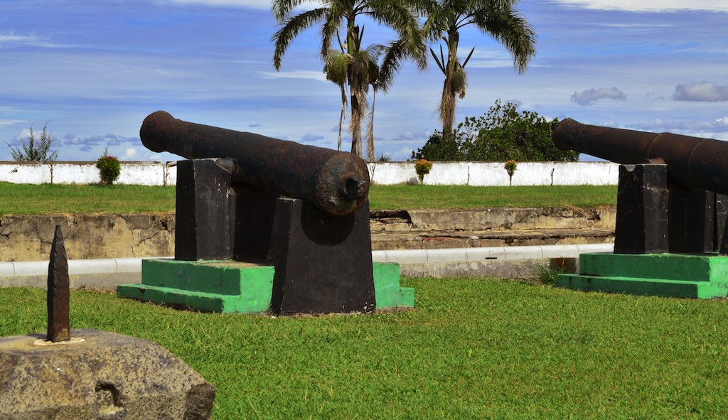
He cited Fort Marlborough in Bengkulu and Fort Vredeburg in Yogyakarta as man-made features that preserved their foreign names due to their historical significance.
“In short, foreign names can’t be randomly given to objects located on Indonesia's surface area,” he told the Post.
“The use of indigenous and foreign languages in geographical names are exceptions and not the norm. Such names must carry historical, cultural, traditional and/or religious significance.”