TheJakartaPost
Please Update your browser
Your browser is out of date, and may not be compatible with our website. A list of the most popular web browsers can be found below.
Just click on the icons to get to the download page.

Popular Reads
Top Results
No results found. Please check your search term and try again
Can't find what you're looking for?
View all search resultsPopular Reads
Top Results
No results found. Please check your search term and try again
Can't find what you're looking for?
View all search resultsMap showing where people can see Mt. Fuji released online
Change text size
Gift Premium Articles
to Anyone
Share the best of The Jakarta Post with friends, family, or colleagues. As a subscriber, you can gift 3 to 5 articles each month that anyone can read—no subscription needed!
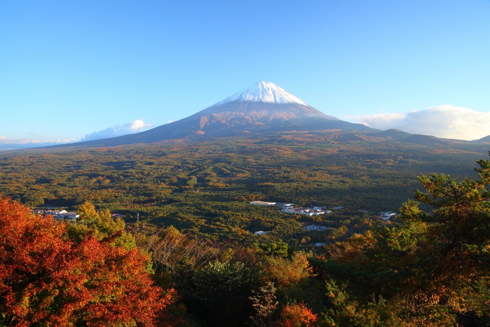 View of Mount Fuji with Aokigahara forest in autumn in Yamanashi, Japan. (Shutterstock/File)
A
special map of Japan indicating areas where Mt. Fuji can be observed was released online on Monday to help people discover different faces of the country's highest and most famous peak.
The map "Mt. Fuji here" by Tokyo-based Japan Map Center indicates with red coloring areas where the 3,776-meter peak can be observed and shows that the world heritage site can be seen from as far away as mountains straddling Mie and Wakayama prefectures more than 300 kilometers to the southwest.
"We would be happy if we can help people make new discoveries," said Hiroshi Tashiro, an expert on mountain views and an adviser to the center. As an example of new sightings, he referred to a phenomenon called Diamond Fuji, which occurs when the sun aligns with the peak, causing it shine brightly like a diamond.
The map allows an online user to change settings to set place names to English, switch the background map to outline, topographical or aerial image, learn the distance between a point of their choice to the mountain and see photographs taken from different locations over 100 km away from Mt. Fuji among other functions.
Read also: Tourists cause human traffic jam at Mt. Fuji
The latest product is one of seven maps of Geospacial Information Authority of Japan with additional information provided by the center that are disclosed online. Among the others is one indicating World Cultural Heritage sites in Japan.
"We tried to maintain the visibility of the GSI map while caring about its usability," said Kazuhiro Takemura, who developed the Mt. Fuji map.
The map is available at https://info.jmc.or.jp/fujisankoko.