TheJakartaPost
Please Update your browser
Your browser is out of date, and may not be compatible with our website. A list of the most popular web browsers can be found below.
Just click on the icons to get to the download page.

Popular Reads
Top Results
No results found. Please check your search term and try again
Can't find what you're looking for?
View all search resultsPopular Reads
Top Results
No results found. Please check your search term and try again
Can't find what you're looking for?
View all search resultsGot a Google Maps link on floods? Careful, it’s misinformation, says BNPB
In a real-life, real-time lesson, the disaster management agency has highlighted the need for users to verify any information before acting on it.
Change text size
Gift Premium Articles
to Anyone
Share the best of The Jakarta Post with friends, family, or colleagues. As a subscriber, you can gift 3 to 5 articles each month that anyone can read—no subscription needed!
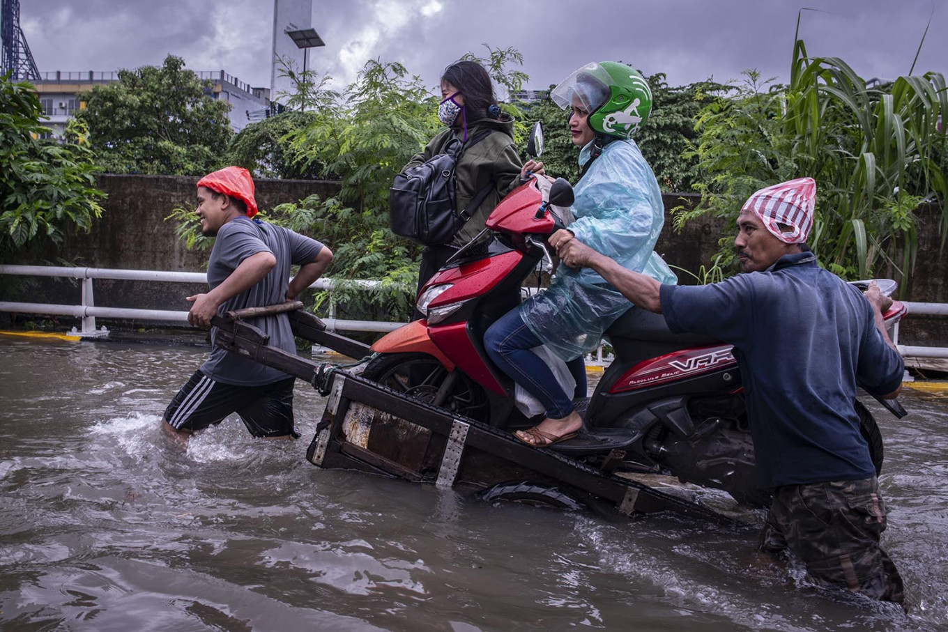 Novel commute: Two men use a cart to carry a motorcycle, its ride-hailing driver and her passenger through floodwaters on the morning of Feb. 25 in Grogol, Jakarta. (Antara/Aprillio Akbar)
T
he National Disaster Mitigation Agency (BNPB) has cautioned city residents over a widely shared link to Google Maps purporting to show flooded areas in Jakarta.
Beredar secara luas peta banjir terlampir, ada juga yang diedarkan via link google maps. Peta tersebut adalah peta genangan banjir thn 2013. Peta yang update berdasar laporan masy bisa diakses di https://t.co/LhQnyCWoMx @BNPB_Indonesia @TurnBackHoax #banjir2020 #Jabodetabek pic.twitter.com/OHp6iffl9R
— Agus Wibowo (@aw3126) February 25, 2020“The attached flood [area] map has been widely shared. It is also being shared as a Google Maps link. The map shows flooded areas in 2013. The updated flood map based on public reports can be accessed at petabencana.id,” BNPB spokesperson Agus Wibowo posted to Twitter on Tuesday.
Following the link reveals that the map was created on Jan. 20, 2013.
The map, which shows massive flooding across most of Jakarta, has been circulating via messaging apps and on social media since Tuesday morning.
Google Indonesia did not immediately respond to The Jakarta Post's request for comment.
Residents once again awoke to widespread flooding on Tuesday, following heavy overnight rains in the capital and surrounding areas.
Mild to severe flooding across Greater Jakarta has paralyzed traffic on several major roads and disrupted public transportation.