TheJakartaPost
Please Update your browser
Your browser is out of date, and may not be compatible with our website. A list of the most popular web browsers can be found below.
Just click on the icons to get to the download page.

Popular Reads
Top Results
No results found. Please check your search term and try again
Can't find what you're looking for?
View all search resultsPopular Reads
Top Results
No results found. Please check your search term and try again
Can't find what you're looking for?
View all search resultsEarthquake of magnitude 6.7 strikes Papua
The quake was at a depth of 70 km (43.5 miles), USGS said.
Change text size
Gift Premium Articles
to Anyone
Share the best of The Jakarta Post with friends, family, or colleagues. As a subscriber, you can gift 3 to 5 articles each month that anyone can read—no subscription needed!
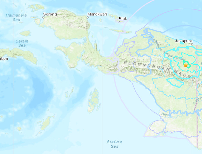 A screen capture of amap from USGS website shows a yellow star indicating the location of a 6.1-magnitude earthquake in Papua province on Sunday, Dec. 16, 2018. (JP/-)
An earthquake of magnitude 6.7 struck Papua province on Thursday, the United States Geological Survey (USGS) said.
The quake was at a depth of 70 km (43.5 miles), USGS said.
The epicentre of the quake, which struck around 2:48 pm local time (0548 GMT), was about 200 kilometres (125 miles) from Jayapura, at a depth of 35 kilometres, the USGS said.
There was no tsunami warning after the quake, the Pacific Tsunami Warning Center said.
On Friday last week, Mount Lewotobi Laki-Laki volcano in East Nusa Tenggara spewed a 10-kilometre (6.2-miles) molten plume of ash topped by lightning, weeks after another huge eruption triggered dozens of flight cancellations in Bali.
Mount Lewotobi Laki-Laki, a 1,584-metre-high volcano on the tourist island of Flores, erupted at 20:48 pm (1248 GMT), the volcanology agency said in a statement.

There were no immediate reports of damages or casualties.
The eruption was triggered by a gas buildup in recent weeks.