TheJakartaPost
Please Update your browser
Your browser is out of date, and may not be compatible with our website. A list of the most popular web browsers can be found below.
Just click on the icons to get to the download page.

Popular Reads
Top Results
No results found. Please check your search term and try again
Can't find what you're looking for?
View all search resultsPopular Reads
Top Results
No results found. Please check your search term and try again
Can't find what you're looking for?
View all search resultsDrone flown over Mount Agung to detect volcanic activity
Change text size
Gift Premium Articles
to Anyone
Share the best of The Jakarta Post with friends, family, or colleagues. As a subscriber, you can gift 3 to 5 articles each month that anyone can read—no subscription needed!
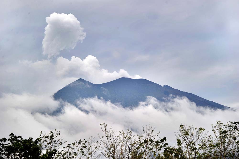 The view of Mount Agung volcano from the Kubu sub-district in Karangasem Regency, Bali on Nov. 22.
The volcano on Bali spewed ash and towering clouds of smoke on Tuesday. (AFP/Sonny Tumbelaka)
The view of Mount Agung volcano from the Kubu sub-district in Karangasem Regency, Bali on Nov. 22.
The volcano on Bali spewed ash and towering clouds of smoke on Tuesday. (AFP/Sonny Tumbelaka)
T
he Center for Volcanology and Geological Hazards (PVMBG) flew a drone over Mount Agung's crater in Bali on Thursday to analyze ash clouds and volcanic activity after the volcano erupted on Tuesday.
A large Ai 450 drone was flown and controlled from a field near the volcano in Karangasem Regency. PVMBG drone team member Umar Rusadi said the drone is larger than the Ai 300 used on previous missions.
The drone is equipped with a sensor capable of detecting chemical substances, such as sulfur dioxide and hydrogen sulfide, to allow the team to examine the activity.
Read also: Singapore's Mt. Agung travel advisory `excessive': BNPB“The drone will comb the southern area of Mount Agung. This flight focuses on detecting sulfur dioxide and hydrogen sulfide contents after it [Mount Agung] has a phreatic eruption on Tuesday,” Umar said on Thursday as quoted by tribunnews.com.
Mount Agung erupted on Tuesday afternoon, spewing thick clouds of ash around 700 meters from the crater. The eruption took place one month after the authorities lowered the alert level to the third-highest level. Currently, areas within six kilometers from the crater have been declared a danger zone.
Read also: A mountain like no otherAs of Thursday, the volcano’s alert status has not disrupted tourism on the resort island. The mountain is located around 70 kilometers from Kuta, one of the most popular destinations on the island. (saf/dmr)