TheJakartaPost
Please Update your browser
Your browser is out of date, and may not be compatible with our website. A list of the most popular web browsers can be found below.
Just click on the icons to get to the download page.

Popular Reads
Top Results
No results found. Please check your search term and try again
Can't find what you're looking for?
View all search resultsPopular Reads
Top Results
No results found. Please check your search term and try again
Can't find what you're looking for?
View all search resultsSouth Sumatra disaster agency lacks real-time monitoring of forest fires
The agency head Iriansyah said it still heavily relied for information on hot spots in the region on satellite monitoring provided by the National Institute of Aeronautics and Space (Lapan)
Change text size
Gift Premium Articles
to Anyone
Share the best of The Jakarta Post with friends, family, or colleagues. As a subscriber, you can gift 3 to 5 articles each month that anyone can read—no subscription needed!
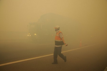
 A toll road workers directs traffic amid thick haze from forest and land fires in Pulau Semembu village, Ogan Ilir regency in South Sumatra on Monday. (JP/Ahmad Rizki Prabu)
S
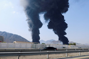
outh Sumatra Disaster Mitigation Agency (BPBD) still does not have a real-time monitoring system to help tackle forest and land fires despite the declaration of emergency status by the governor in March, a top official has said.
The agency head Iriansyah said it still heavily relied for information on hot spots in the region on satellite monitoring provided by the National Institute of Aeronautics and Space (Lapan)
However, the Lapan Fire application provides information on hotspots only four to 24 hours after the event, which hampers swift firefighting efforts.
“Lapan’s non-real time reports are a challenge,” Iriansyah said at his office on Monday, adding that the agency also counted on land patrols in dealing with fires.
Some 1,500 personnel were deployed to patrol 90 subdistricts vulnerable to forest and land fires. However, often the patrols encounter problems such as fires in locations that are difficult to access, peatland fires, hot weather and strong winds, limited access to water resources and a lack of water tankers.
“For such land operations we need support from drones,” he said.
In general, Lapan satellites have shown a significant increase in the number of hotspots in the province this month, with 645 hot spots detected, most of which are in Ogan Komering Ilir (OKI) regency.