TheJakartaPost
Please Update your browser
Your browser is out of date, and may not be compatible with our website. A list of the most popular web browsers can be found below.
Just click on the icons to get to the download page.

Popular Reads
Top Results
No results found. Please check your search term and try again
Can't find what you're looking for?
View all search resultsPopular Reads
Top Results
No results found. Please check your search term and try again
Can't find what you're looking for?
View all search resultsSeroja cyclone may bring more disasters to eastern Indonesia
The Meteorology, Climatology and Geophysics Agency (BMKG) has warned of more danger after massive flooding and landslides hit East and West Nusa Tenggara at the weekend.
Change text size
Gift Premium Articles
to Anyone
Share the best of The Jakarta Post with friends, family, or colleagues. As a subscriber, you can gift 3 to 5 articles each month that anyone can read—no subscription needed!
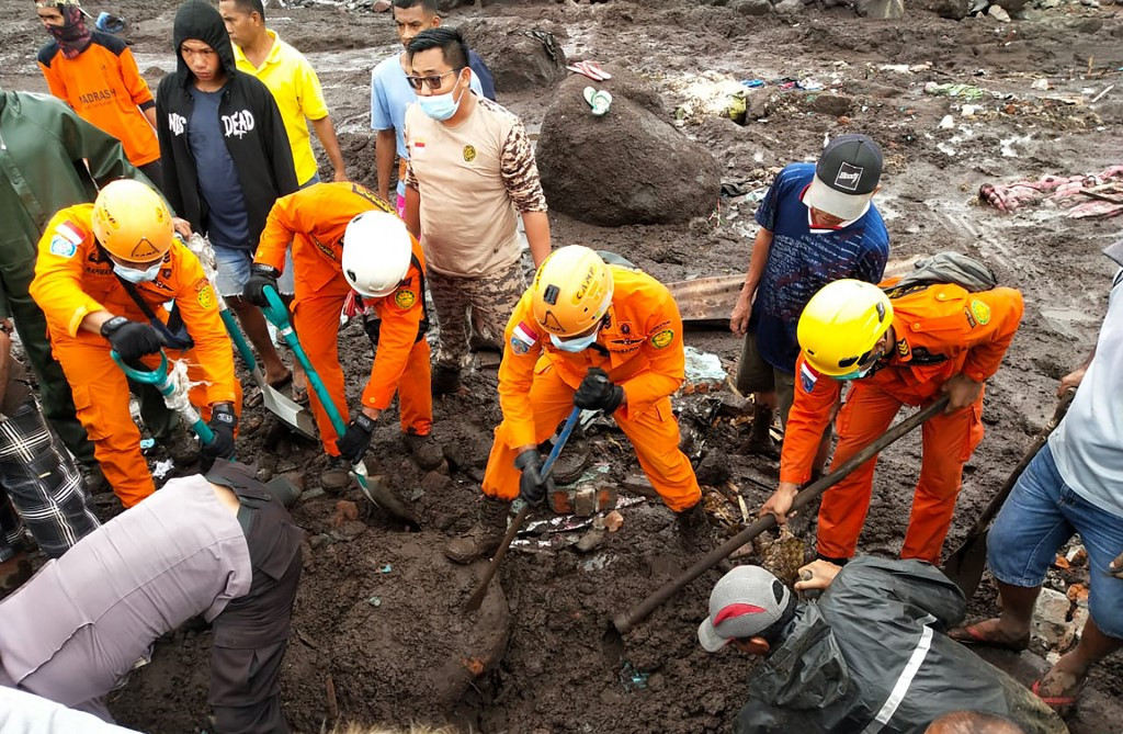 This handout photo taken on Monday and released by the National Search and Rescue Agency (BASARNAS) shows rescuers looking for survivors in Nelemamadike village, East Flores, after torrential rains triggered floods and landslides in Indonesia and Timor Leste. (AFP/Handout)
T
he Meteorology, Climatology and Geophysics Agency (BMKG) has warned of heightened weather activity that could lead to more disasters, as the clear-up following widespread flooding and landslides in East Nusa Tenggara (NTT) and West Nusa Tenggara (NTB) continued this week.
The agency projected that heavy sea conditions might hit the provinces as the Seroja tropical cyclone, which is believed to have caused the disaster, would last until at least Wednesday.
“Apart from heavy rains, we will also see strong winds and high waves that may resemble a tsunami. These high waves may make landfall,” BMKG head Dwikorita Karnawati told a press conference on Tuesday morning.
She said the waves formed would not be as strong as those caused by a tsunami but that they would still be “damaging”, appearing at different heights in several areas across eastern Indonesia’s waters.
Waves reaching between 1.25 to 6 meters in height are projected to occur in parts of the Sumba Strait, the Sape Strait, the Wetar Strait, the Sumbawa Sea, the South Banda Sea, the Arafuru Sea, the Sawu Sea, as well as the waters of Flores, Baubau, Sumba, Kupang, Rote, Sabalana Islands, Selayar Islands and Wakatobi Islands.
Rains of moderate to heavy intensity, accompanied by lightning and strong winds, may also hit areas of Bali, South Sulawesi and Southeast Sulawesi.
After Wednesday, Seroja’s vortex speed is forecast to continue strengthening, although it will move in a southwesterly direction away from the Indonesian land mass. The vortex speed has increased to 110 kilometers per hour from 85 km/h when it was detected last Friday, and is predicted to reach a height of 130 km/h.