TheJakartaPost
Please Update your browser
Your browser is out of date, and may not be compatible with our website. A list of the most popular web browsers can be found below.
Just click on the icons to get to the download page.

Popular Reads
Top Results
No results found. Please check your search term and try again
Can't find what you're looking for?
View all search resultsPopular Reads
Top Results
No results found. Please check your search term and try again
Can't find what you're looking for?
View all search results7.6-magnitude earthquake hits east Papua New Guinea: USGS
The US Geological Survey, which reported the quake, issued a tsunami warning but subsequently said the threat "has now passed".
Change text size
Gift Premium Articles
to Anyone
Share the best of The Jakarta Post with friends, family, or colleagues. As a subscriber, you can gift 3 to 5 articles each month that anyone can read—no subscription needed!
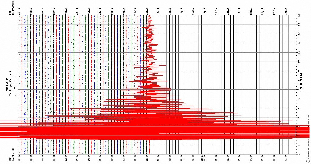 This image from the US Geological Survey (USGS) shows a tremblor gauged on a seismograph 22 December 2003, described as a major earthquake measuring 6.5 on the Richter scale, which shook central and southern California. (AFP/AFP)
A
7.6-magnitude earthquake hit off eastern Papua New Guinea on Sunday, with locals reporting damage to buildings near the town of Madang and further inland.
The US Geological Survey, which reported the quake, issued a tsunami warning but subsequently said the threat "has now passed".
It did, however, note that there could still be "minor sea level fluctuations in some coastal areas".
Locals in Madang who spoke to AFP said they felt "very strong shaking". There were reports of damage to buildings.
The quake struck at a depth of 61 kilometres (38 miles), about 67 kilometres from the town of Kainantu, the USGS said.
Papua New Guinea sits on the Pacific "Ring of Fire", causing it to experience frequent earthquakes.
Earlier on Saturday, a strong 6.2-magnitude earthquake jolted a coastal region of Papua and was followed by two weaker aftershocks minutes later, the USGS said.
The first two quakes -- the second a 5.8-magnitude tremor -- hit at a relatively shallow depth of 15 kilometres, about 272 kilometres (169 miles) from the town of Abepura, according to the USGS.
A third 5.9-magnitude quake then hit the area at a depth of 32 kilometres.
No casualties or damages were immediately reported by authorities and no tsunami warning accompanied the inland quakes.
But the Indonesian Meteorology and Geophysics Agency (BKMG) warned of moderate shaking and potential light damage.
It also told residents of nearby towns to "watch out for possible aftershocks" in its online advisory.
BKMG earthquake and tsunami coordinator Daryono, who like many Indonesians goes by one name, told AFP no reports of damage were immediately available from the area.
The official, citing the agency's modelling, said the quakes were lightly felt by residents in Sarmi, a coastal town of about 11,000 people close to the epicentre, and the neighbouring Mamberamo area, home to about 36,000 people.
Indonesia is one of the most disaster-prone nations on Earth.
The country experiences frequent earthquakes due to its position on the Pacific "Ring of Fire", an arc of intense seismic activity where tectonic plates collide, that stretches from Japan through Southeast Asia and across the Pacific basin.
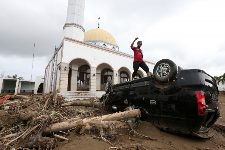
A 6.2-magnitude quake that shook Sulawesi island in January 2021 killed more than 100 people and left thousands homeless, reducing buildings to a tangled mass of twisted metal and chunks of concrete in the seaside city of Mamuju.
In 2018, a 7.5-magnitude quake and a subsequent tsunami in Palu on Sulawesi killed more than 2,200 people with a thousand more declared missing.
On December 26, 2004, a 9.1-magnitude earthquake struck Aceh province, causing a tsunami and killing more than 170,000 people in Indonesia.