TheJakartaPost
Please Update your browser
Your browser is out of date, and may not be compatible with our website. A list of the most popular web browsers can be found below.
Just click on the icons to get to the download page.

Popular Reads
Top Results
No results found. Please check your search term and try again
Can't find what you're looking for?
View all search resultsPopular Reads
Top Results
No results found. Please check your search term and try again
Can't find what you're looking for?
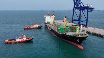
View all search resultsRI’s position in the South China Sea dispute
For those interested in international relations and maritime affairs, it is hard to miss the tension building in the South China Sea (SCS)
Change text size
Gift Premium Articles
to Anyone
Share the best of The Jakarta Post with friends, family, or colleagues. As a subscriber, you can gift 3 to 5 articles each month that anyone can read—no subscription needed!

F
or those interested in international relations and maritime affairs, it is hard to miss the tension building in the South China Sea (SCS). Some opine that the SCS is one of the hottest territorial and jurisdictional disputes in modern history.
The territorial dispute involves sovereignty over relatively small islands/rocks/low-tide elevations (LTEs) in the region. Since the maritime area of islands and rocks are measured from their coastline/baselines, water column and seabed, they too are subjects of dispute in the SCS.
The SCS is a semi-enclosed sea surrounded by China, Vietnam, Malaysia, Singapore, Indonesia, Brunei Darussalam, the Philippines and Taiwan. The region has hundreds of small islands/rocks/LTEs disputed by a number of countries. Some studies also indicate that the SCS is relatively rich in living and non-living resources, which undoubtedly adds further complexity. Due to the complexity of the SCS issue, for the first time in history, ASEAN could not reach a consensus in its recent meeting.
Indonesia, for its part, is not a claimant to any disputed territories in the SCS (Spratly, Pratas, Paracels Islands, etc). However, Indonesia is entitled to maritime area in the SCS as in the Natuna Islands. As it is an archipelagic country, Indonesia may claim territorial sea, exclusive economic zone (EEZ) and continental shelf measured from archipelagic baselines, which connect the outermost points of its outer islands.
Consequently, Indonesia could theoretically claim a large area of waters in the SCS. On the other hand, Malaysia and Vietnam, two of Indonesia’s closest neighbors in the region, are also entitled to maritime areas, which to a large extent overlap with Indonesia’s. To deal with this issue, Indonesia has delimited seabed (continental shelf) boundaries with Malaysia (1969) and Vietnam (2003). However, maritime delimitation for water column has yet to be done.
In addition to claiming sovereignty, some countries also occupy small islands in the SCS. Spratly Island, for example, is occupied by Vietnam in the forms of a settlement, airstrip and a monument. Others are also occupied by a number of countries. Additionally, many of the features in the SCS have names in multiple languages, adding to the confusion and uncertainty regarding the exact number of disputed islands.
Countries in the region also claim maritime areas around disputed islands/rocks/LTEs. China, for example, has claimed almost the entire SCS by issuing a map depicting dashed lines enclosing land and maritime area in the region. The map was issued in 1947, depicting dashed lines that are now known as “nine-dashed line” for it has nine segments (Li and Li, 2003).
Unfortunately, it is not clear whether the nine dashed line intends to claim only islands/rocks in the region or include maritime areas around them. Since the claim is depicted by a dashed line, not a continuous one, it is hard to tell which areas are precisely included in China’s claim.
Assured of its neutral position, Indonesia, through Prof. Hasjim Djalal, initiated workshops on Managing Potential Conflicts in the SCS. Interestingly, in the 1993 workshop, the Chinese delegation presented a map illustrating its country’s “historic waters” that showed that China’s claimed areas overlapped with Indonesia’s EEZ adjacent to the Natuna Islands. Consequently, it was suggested that Indonesia was being “drawn into the fray” of the South China Sea disputes (Johnson, 1997).
Indonesia asked for clarification from China regarding the claim, but China offered no explanation. Instead, china offered a negotiated solution that Indonesia rejected, since Indonesia does not see the need for maritime negotiation with China.
Indonesia further confirmed its rejection by stating that that the nine-dashed line map of China “lack[s] international basis” and therefore its purpose is “tantamount to upset[ting]” the 1982 United Nations Convention on the Law of the Sea (UNCLOS). In other words, Indonesia does not consider China one of its neighbors with which it must settle maritime boundaries.
On the other hand, China seems to have a different view. In 2010, for example, Chinese fishermen were caught fishing in waters off the Natuna Islands, which Indonesia unilaterally considers as part of its EEZ. When patrolling Indonesian officers approached to arrest the vessels, a large Chinese vessel arrived and demanded that the vessels be released.
This gives the impression that the fishing vessels were guarded by a large vessel known as the “Chinese fishery administration vessel”. It can be inferred that China has extended its maritime claim up to the area that Indonesia believes to be its.
The aforementioned incident implies that Indonesia is not totally free from the SCS conflict. Even though it is not disputing the sovereignty of any small islands/rocks/LTEs in the region, Indonesia’s entitlement over maritime area in the SCS can generate an overlapping area that leads to maritime delimitation. EEZ delimitation with Malaysia and Vietnam is inevitable for Indonesia.
A geospatial technical analysis shows that there is also a possibility of overlapping maritime claims between Indonesia and China. Unfortunately, China has never declared the precise coordinates of its claim so the analysis was performed using several assumptions.
However, even a rough examination of Chinese and Indonesian maps easily shows the possibility of overlapping claims. Indonesia’s claim over its EEZ that extends beyond its continental shelf (seabed) in the SCS indicates a possibility that the overlapping claim with China is even larger, not to mention that with Vietnam and Malaysia.
Chinese fishermen fishing in waters around the Natuna Islands is further evidence of Chinese’s assertive claim. This may to a certain extent change Indonesia’s view regarding its involvement in the SCS dispute.
In conclusion, Indonesia can never completely avoid the complexities in the SCS. Like it or not, Indonesia is involved in maritime division in the area, at least with Malaysia and Vietnam.
Meanwhile, the need for maritime delimitation with China will highly depend on clarification of China’s maritime claim. Indonesia, on the other hand, is firm in its stance that China is not one of its neighbors with which maritime delimitation is required.
It is also worth noting that Indonesia is not in any way involved in territorial land disputes in the region. However, it is quite clear that Indonesia is not without any interest in the SCS.
The writer, a lecturer at the school of geodetic engineering, Gadjah Mada University, is a PhD candidate with the Australian leadership awards at the University of Wollongong, Australia.