TheJakartaPost
Please Update your browser
Your browser is out of date, and may not be compatible with our website. A list of the most popular web browsers can be found below.
Just click on the icons to get to the download page.

Popular Reads
Top Results
No results found. Please check your search term and try again
Can't find what you're looking for?
View all search resultsPopular Reads
Top Results
No results found. Please check your search term and try again
Can't find what you're looking for?
View all search resultsGoogle Street View to capture running and walking trails in Singapore
Change text size
Gift Premium Articles
to Anyone
Share the best of The Jakarta Post with friends, family, or colleagues. As a subscriber, you can gift 3 to 5 articles each month that anyone can read—no subscription needed!
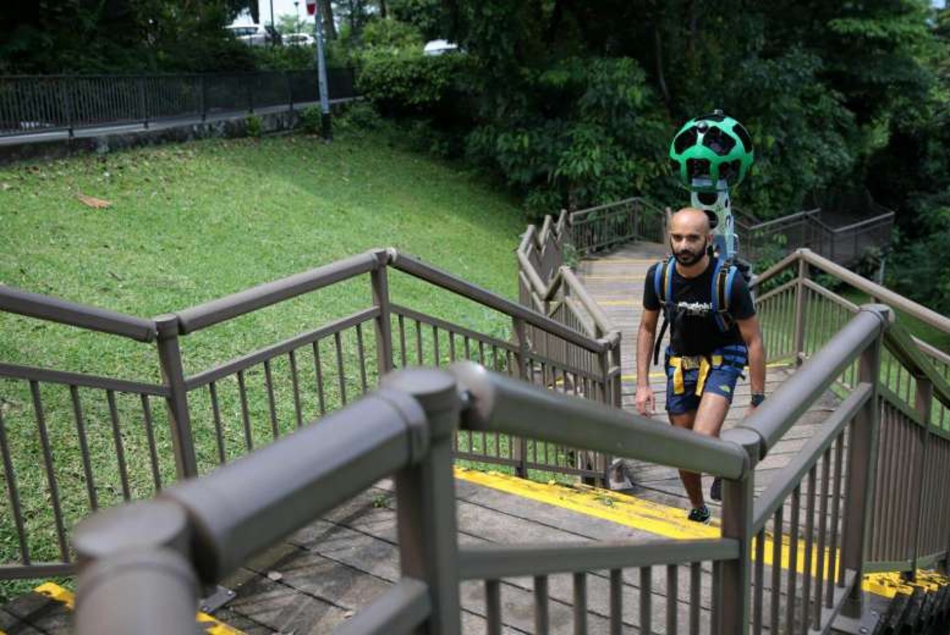 Paviter Singh Jahangir, a runner with JustRunLah!, who has partnered with Google to map out trekking trails in Singapore. (The Straits Times/Ong Wee Jin)
People who are looking for a new nature trail to stretch their legs can soon search for them on the Google Street View application.
Google Singapore on Thursday (April 27) said they will be working with Singapore-based running platform JustRunLah! to visually map these trails.
Equipped with the Google Street View trekker - which is previously used to map overseas locations such as the Grand Canyon - members of the running group will record 30 running and walking trails across the island.
 Paviter Singh Jahangir viewing a 360 degrees Google Street View with his phone attached to the cardboard piece, acting as VR goggles.(The Straits Times/Ong Wee Jin)
Read also: Japan museums abandoning no-photos policy
The Street View Trekker consists of 15 cameras mounted over a mobile computer, with the capability to capture 360-degree images. The device weighs 20kg and is mounted to a frame with straps to allow the runner to carry it easily.
JustRunLah! hopes that mapping the trails on Street View will allow runners to visualise and better plan their trail routes.
Google also announced that its Special Collections programme, which is found within the Street View mobile app or on a Web browser, has been updated with 30 indoor and outdoor attractions in Singapore. These include Coney Island Park and the National Gallery Singapore. The segment highlights interesting sites around the world.
"Singapore is a top Asian destination for tourists worldwide and having the newly added Special Collections will give tourists a first glance at their trip planning," said Cynthia Wei, 34, Street View programme manager.
This article appeared on The Straits Times newspaper website, which is a member of Asia News Network and a media partner of The Jakarta Post