TheJakartaPost
Please Update your browser
Your browser is out of date, and may not be compatible with our website. A list of the most popular web browsers can be found below.
Just click on the icons to get to the download page.

Popular Reads
Top Results
No results found. Please check your search term and try again
Can't find what you're looking for?
View all search resultsPopular Reads
Top Results
No results found. Please check your search term and try again
Can't find what you're looking for?
View all search resultsMt. Semeru eruptions trigger local advisories
While authorities have maintained Mt. Semeru's status at Level II (advisory), they have advised people to remain vigilant and to avoid activities in the designated exclusion zone to the volano's southeast.
Change text size
Gift Premium Articles
to Anyone
Share the best of The Jakarta Post with friends, family, or colleagues. As a subscriber, you can gift 3 to 5 articles each month that anyone can read—no subscription needed!
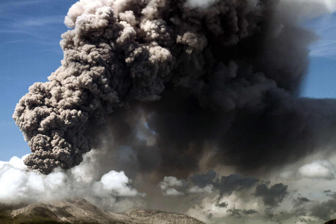 Mount Lewotobi Laki-laki on Flores Island erupts with a great cloud of gray ash on Nov. 7, 2024, as seen from Lewolaga village in East Flores, East Nusa Tenggara. (Antara Foto/Mega Tokan)
M
ount Semeru, located on the border between Lumajang and Malang in East Java, erupted several times on Thursday morning, sending columns of ash up to a height of 1 kilometer above the stratovolcano’s Mahameru Peak.
Data from the Semeru Observation Post in Lumajang reported 10 eruptions between midnight and 8 a.m. on Nov. 7, with ash columns varying in height between 300 meters and 1,000 m above the mountain’s summit.
“The first eruption occurred at 12:24 a.m. WIB [Western Indonesian Time]. The plume reached 600 meters above the peak. It dispersed white to gray ash to the south and southwest. The seismic record showed a maximum amplitude of 22 [millimeters]. The duration was 122 seconds,” Semeru Observation Post official Ghufron Alwi said, as quoted by Antara news agency.
Another eruption occurred at 12:51 a.m., with an ash column 800 m high. The largest eruption occurred at 5:26 a.m., with an ash column reaching 1,000 m, as eruptions continued at intervals throughout Thursday morning.
Authorities have maintained Mt. Semeru's status at Level II for Waspada (advisory) on the four-tier volcano alert system, and advised people to avoid activities within a southeastern area stretching 8 km to the Besuk Kobokan River, the projected path of the lava flow.
Beyond this area, people should avoid activities within 500 m along the river due to the potential expansion of pyroclastic clouds and lahars up to 13 kilometers from the summit.

“Residents are also not allowed to conduct any activities in a radius of 3 kilometers from the summit of Mt. Semeru due to danger from burning rockfall,” said Ghufron.
In addition to Besuk Kobokan, residents are also asked to be alert to potential pyroclastic cloud, lava and lahar along the Besuk Kembar and Besuk Sat rivers and their tributaries.
Eruptions elsewhere
The status for Mt. Marapi in West Sumatra's Agam and Tanah Datar regencies has been raised to Level III for Siaga (watch) following intensified activities since late October.
Ash plumes as high as 2,000 m above the summit were detected on Oct. 27, with the latest observation recording a 1,500 m-high column of ash early morning on Wednesday.
The Energy and Mineral Resources Ministry’s Geology Agency has advised residents, climbers and visitors to avoid the area within a 4.5 km radius from Verbeek Crater, the epicenter of volcanic activities.
Meanwhile, the National Disaster Mitigation Agency (BNPB) has called on local administrations to immediately prepare measures for mitigating the potential impacts from a major eruption at Mt. Marapi.
These included, “if necessary, evacuating the residents immediately”, BNPB chief Lt. Gen Suharyanto told a virtual online press conference on Thursday.
In East Nusa Tenggara’s East Flores regency, Mount Lewotobi Laki-laki, currently at the highest status of Level IV for Awas (danger), erupted again on Thursday, emitting an ash column 2,500 m into the sky above the summit, or around 4,000 m above sea level.
The eruption occurred at 8:53 a.m. local time with a loud boom and pyroclastic flows extending 1 km to the northwest.
Authorities have established a 7 km exclusion zone around the stratovolcano, advising local residents to beware of potential lahars along rivers flowing from the mountain.