TheJakartaPost
Please Update your browser
Your browser is out of date, and may not be compatible with our website. A list of the most popular web browsers can be found below.
Just click on the icons to get to the download page.

Popular Reads
Top Results
No results found. Please check your search term and try again
Can't find what you're looking for?
View all search resultsPopular Reads
Top Results
No results found. Please check your search term and try again
Can't find what you're looking for?
View all search resultsIndigenous knowledge helps save lives in flood-hit Malalo, Sumatra
Change text size
Gift Premium Articles
to Anyone
Share the best of The Jakarta Post with friends, family, or colleagues. As a subscriber, you can gift 3 to 5 articles each month that anyone can read—no subscription needed!
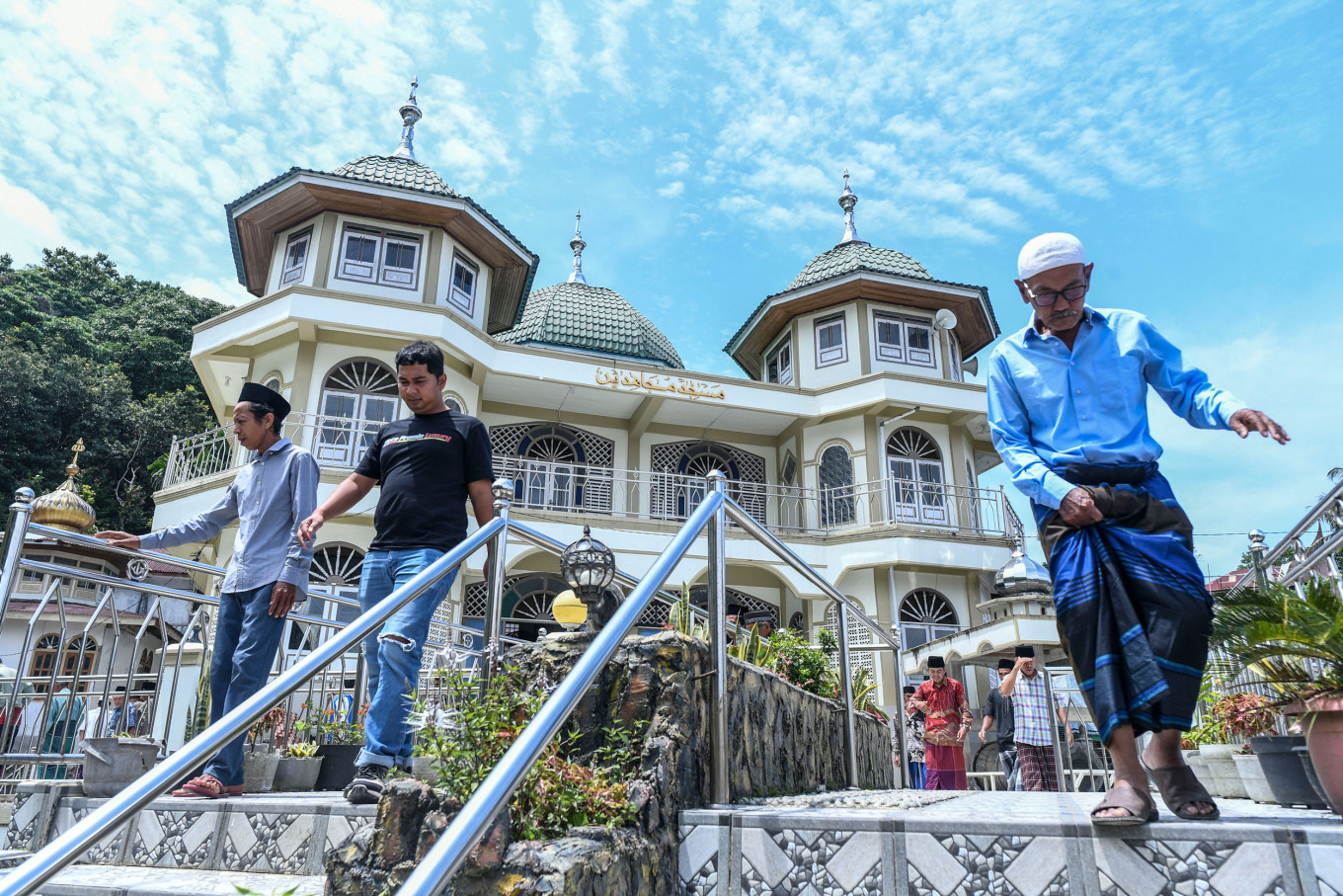 Muslim survivors of the flash flood in West Sumatra walk out of the mosque on Feb. 20 after Friday prayers at the Mujahiddin Duo Koto Mosque in Guguak Malalo village, Tanah Datar, West Sumatra. The first Friday prayer of Ramadan 1447 Hijriah in one of the areas affected by the flash floods in November 2025 took place solemnly. (ANTARA FOTO/Wahdi Septiawan)
E
vidence shows that Indigenous, community-based mitigation systems are effective in saving lives during disasters. Therefore, legal recognition of Indigenous communities and customary forests is an urgent priority, alongside efforts to strengthen local knowledge systems and ensure their sustainability.
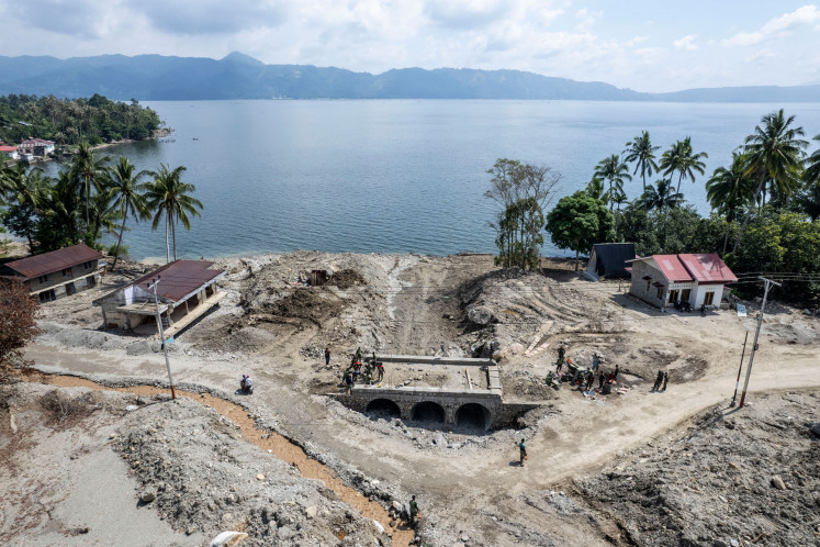
When flash floods swept across parts of Sumatra in late November 2025, rivers surged, hillsides collapsed, roads were destroyed, and farms were buried under rocks and mud. In many areas, the disaster caused significant damage and casualties.
But in the highland communities of Malalo Tigo Jurai in West Sumatra’s Tanah Datar district, something unusual happened: despite widespread destruction, no one died.
For residents, this outcome was not simply a matter of luck. Community elders say it was the result of an Indigenous disaster mitigation system practiced for generations.
Weeks of heavy rainfall triggered flash floods, locally known as galodo, across the steep slopes surrounding Lake Singkarak. Five rivers flowing through the Malalo area, Bahiang, Guguak, Duo Koto, Tanjung Sawah, and Rumbai, swelled almost simultaneously. The rushing water carried rocks, mud, and tree trunks from the surrounding hills into settlements along the lake’s edge.
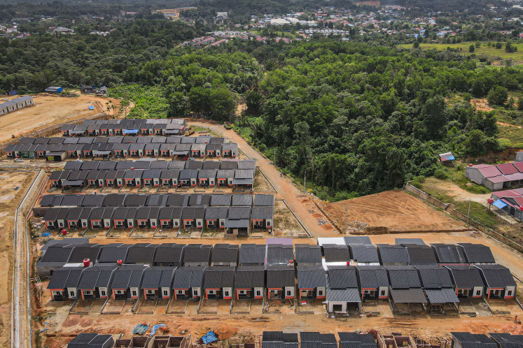
Two nagari, or village-level communities, Guguak Malalo and Padang Laweh Malalo, were cut off for nearly two weeks. At least 17 sections of road were destroyed, more than 200 houses were damaged, and hundreds of hectares of farmland were buried under one to two meters of stones and sediment.

The disaster wiped out the main sources of livelihood for many residents. Local officials recorded that 392 families lost their rice fields, while 351 families lost their plantations. Yet even as homes and farms were devastated, there were no fatalities or serious injuries.
Community leaders say evacuation began after warnings from the Tuo Banda, a group of customary river guardians responsible for monitoring waterways in the Malalo area.
“Tuo Banda asked us to evacuate,” said Masnaidi, a traditional leader in Malalo Tigo Jurai.
These guardians regularly inspect the five rivers, clearing fallen trees and sediment from the channels. As rainfall intensified, they worked with younger residents to monitor upstream conditions.
When they saw signs that the rivers might overflow, they instructed residents to leave their homes and evacuate to older settlements on safer ground.
“We call it pulang, returning to our ancestral village,” Masnaidi said. “Those places were chosen by our ancestors because they are safer from galodo.”
The Malalo area lies along steep terrain overlooking Lake Singkarak. Geologically, the area was shaped by volcanic activity from Mount Marapi and movements along the active Sumatra Fault. Locals describe the landscape with the word malolo, meaning soil that easily slips or shifts.
This awareness of unstable terrain has shaped the community’s land management system for centuries. Forests around the Malalo area are traditionally divided into four categories: managed forests for agriculture, gathering forests for collecting forest products, reserve forests protected to maintain water sources, and forbidden forests that cannot be exploited.
The reserve and forbidden forests play a crucial role in protecting watersheds and stabilizing slopes.
Customary knowledge also influences settlement patterns. Homes in Malalo are generally built along an east–west orientation rather than north–south. Some researchers suggest this aligns with the direction of the Sumatra Fault near Lake Singkarak.
This layout has also proven relatively resilient during major earthquakes in West Sumatra. Together with river monitoring and forest protection, these practices form a locally developed disaster mitigation system.
Despite maintaining these systems for generations, Malalo’s community has yet to receive official recognition as an Indigenous legal community from the government.
Since 2014, residents have sought recognition of their customary forest rights. Community leaders say their forest boundaries are well documented, with some markers dating back to the Dutch colonial period. However, obtaining legal recognition remains a long and complex process.
Civil society groups say communities must pass multiple administrative stages involving district administrations, provincial authorities and national ministries before their status can be formally recognized. In many cases, this requires a regional regulation confirming the existence of an Indigenous community, a process that can take years.
Organizations working on Indigenous rights say these bureaucratic requirements often become a major barrier.
“Many Indigenous communities have clear histories, territories and governance systems, but the legal recognition process is extremely complicated,” said Bimantara Ajie from Perkumpulan HUMA. “Communities must navigate layers of verification and political approval before their rights are formally acknowledged.”
Across Indonesia, recognition remains limited. As of January 2026, only around 164 Indigenous communities have been officially recognized, covering approximately 345,000 hectares of customary forest, a small fraction of the country’s more than 120 million hectares of forest.
Adam Putra Firdaus of the Indonesian Center for Environmental Law (ICEL) said the state still dominates forest management decisions.
Paradigm shift
Through the designation of state forest areas, the government determines which territories are classified as forest and who is allowed to manage them. As a result, long-standing community practices are sometimes viewed as threats rather than systems that protect forests.
Data from the Ministry of Environment and Forestry in 2018 shows a significant imbalance: about 95.76 percent of forest areas are under corporate control, while communities manage only 4.14 percent.
“Fundamental problems cannot be solved by technical revisions alone,” Firdaus said. “Indonesia needs a paradigm shift in how forests are governed.”
Following the 2025 galodo disaster, discussions have emerged about relocating residents from high-risk areas.
However, many Malalo residents argue that relocation is not a simple solution. For Indigenous communities, moving would also mean disrupting a knowledge system and a deep relationship with the landscape developed over centuries.
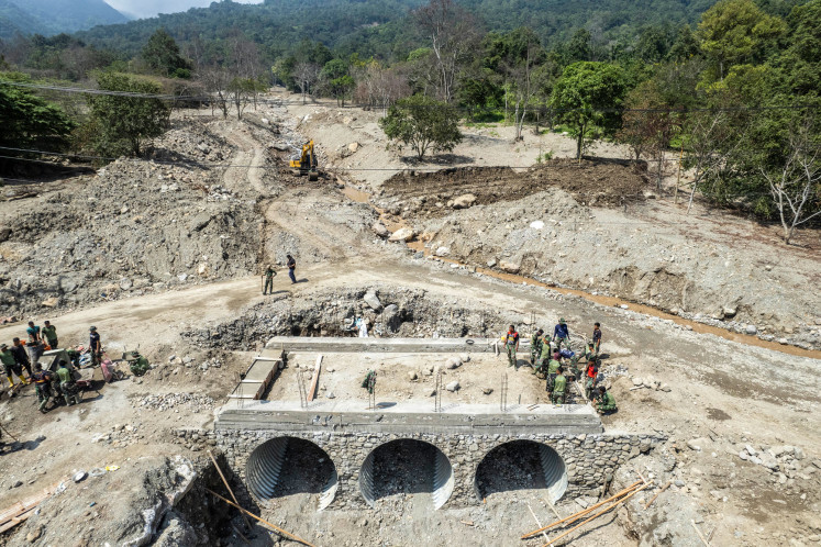
Instead, residents hope the government will prioritize strengthening Indigenous land management systems. They are also calling for river rehabilitation, additional flood-control infrastructure such as check dams, and formal recognition of their customary territory.
Residents note that four check dams already built in the Malalo area helped slow rocks and sediment during the recent floods, reducing the scale of destruction.
In a region increasingly exposed to extreme weather, community leaders emphasize that their ancestral practices are not relics of the past, but a living system that continues to protect lives today.