TheJakartaPost
Please Update your browser
Your browser is out of date, and may not be compatible with our website. A list of the most popular web browsers can be found below.
Just click on the icons to get to the download page.

Popular Reads
Top Results
No results found. Please check your search term and try again
Can't find what you're looking for?
View all search resultsPopular Reads
Top Results
No results found. Please check your search term and try again
Can't find what you're looking for?
View all search resultsCyclone Senyar triggered 330 landslides in South Tapanuli, survey finds
The survey was conducted by direct observation method by following the river flow and using drone for wider coverage on Jan. 21-27.
Change text size
Gift Premium Articles
to Anyone
Share the best of The Jakarta Post with friends, family, or colleagues. As a subscriber, you can gift 3 to 5 articles each month that anyone can read—no subscription needed!
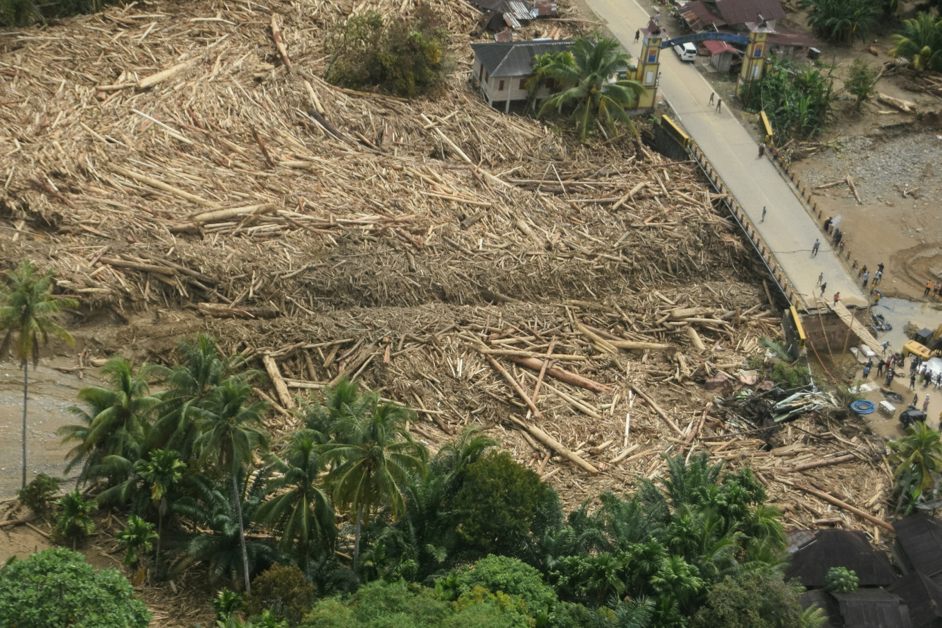 An aerial view of logs on Dec. 2, 2025, which were swept away by a flash flood, stranded in Batang Toru, South Tapanuli, North Sumatra. (Reuters/Stringer)
A
n independent survey found 330 landslides upstream of the Garoga and Siondop rivers after the rare tropical cyclone Senyar struck South Tapanuli regency in North Sumatra in late November.
Conducted by the National Coordination Center of Nature-Loving Students Units (Mapala) and environmental activists, the survey found the most landslide spots, at 245, in the Garoga upstream river area, while the Siondop River had 85.
Survey team head Decky Chandrawan said that 330 landslides were identified in surveys across the two areas. The survey was carried out on Jan. 21-27 with direct observations, by studying the river's flow and using drones for wider coverage.
He said the survey would continue in the near future in several other potential landslide areas, especially those located in the operational areas of several companies recently closed by the government, such as PT NSHE and PT AR.
Read also: Extreme weather, fresh floodings haunt survivors of Sumatra disaster
Decky said he wanted to prove how many landslides there were in areas near these companies.

Most landslides upstream of the Garoga and Siondop rivers were in open forest areas.