TheJakartaPost
Please Update your browser
Your browser is out of date, and may not be compatible with our website. A list of the most popular web browsers can be found below.
Just click on the icons to get to the download page.

Popular Reads
Top Results
No results found. Please check your search term and try again
Can't find what you're looking for?
View all search resultsPopular Reads
Top Results
No results found. Please check your search term and try again
Can't find what you're looking for?
View all search resultsPragmatic options for Jakarta's flood mitigation
While the situation in the nation's capital complicates flood mitigation, primary and supplemental options are still available, depending on the will and willingness of both local administrations and residents.
Change text size
Gift Premium Articles
to Anyone
Share the best of The Jakarta Post with friends, family, or colleagues. As a subscriber, you can gift 3 to 5 articles each month that anyone can read—no subscription needed!
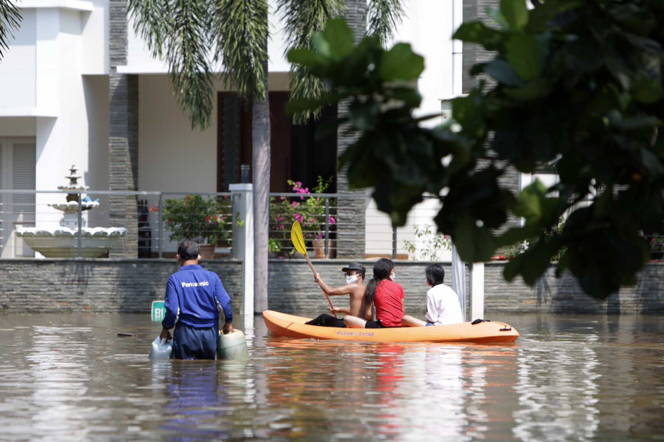 A man rows a kayak carrying two passengers on floodwaters in the Pantai Mutiara housing complex in North Jakarta on June 7, 2020, after the area was hit by a flood. (JP/Wendra Ajistyatama)
M
ost water resources engineers recognize that conventional flood mitigation comprises structural and nonstructural methods, and that the integrated flood control usually involves a combination of these two. Whether the emphasis is given to structural or nonstructural measures depends on prevailing conditions, based on engineering and socioeconomic assessment and viability.
Flooding is generated by overland flow and can be expressed by the simple rational equation Q=CIA, with Q representing overland flow dependent on runoff coefficient (C), rainfall intensity (I) and catchment area (A), where the rain falls, concentrates and flows to the lowest point. Rainfall intensity and catchment area are naturally given, and we cannot modify them. Therefore, the option of controlling a flood depends merely on the modifiable C, and consequently the capability to control Q. Failure to control Q means a disaster.
The rational equation above shows that a smaller C variable generates smaller Q. C is the ratio between overland flow and effective rainfall. In this case, some portion of rainfall is transferred as a different constituent form, evaporating in the air or infiltrating underground. The remaining rainwater runs as overland flow.
To reduce overland flow, we need to increase infiltration capacity. However, increasing infiltration capacity involves dealing with nature, which we cannot fully control. Pragmatically, while our capacity to minimize C is limited, we have total control over confining Q. On this basis, most flood mitigation projects and activities are aimed at confining this overland flow in safe places where human activity is absent or minimal.
When we cannot control overland flow because of intense urban development that did not consider sustainability principles and hence generate a high runoff coefficient, we must be ready for flooding. The inadequate capacity of existing drainage channels and nonexistent conventional reservoirs may exacerbate flooding. This occurs in many Indonesian cities, especially Jakarta.
The capital city has a very complicated situation, given that most parts are low-lying flat land and face seawater intrusion, which makes for a high water table in the northern part of the city. The presence of more than one local administration in the watershed (Jakarta, Bogor, Depok, Tangerang and Bekasi) means that flood mitigation must involve intersectoral and interregional coordination.

Jakarta also has an unfavorable demographic and social structure, with a socioeconomic gap and where urban poverty is ubiquitous. This demographic situation elevates the complexity and difficulty of flood mitigation.