TheJakartaPost
Please Update your browser
Your browser is out of date, and may not be compatible with our website. A list of the most popular web browsers can be found below.
Just click on the icons to get to the download page.

Popular Reads
Top Results
No results found. Please check your search term and try again
Can't find what you're looking for?
View all search resultsPopular Reads
Top Results
No results found. Please check your search term and try again
Can't find what you're looking for?
View all search resultsGovernments need to prepare for more frequent large floods
Governments and experts need to consider both the frequency and size of floods to better prepare for future ones.
Change text size
Gift Premium Articles
to Anyone
Share the best of The Jakarta Post with friends, family, or colleagues. As a subscriber, you can gift 3 to 5 articles each month that anyone can read—no subscription needed!
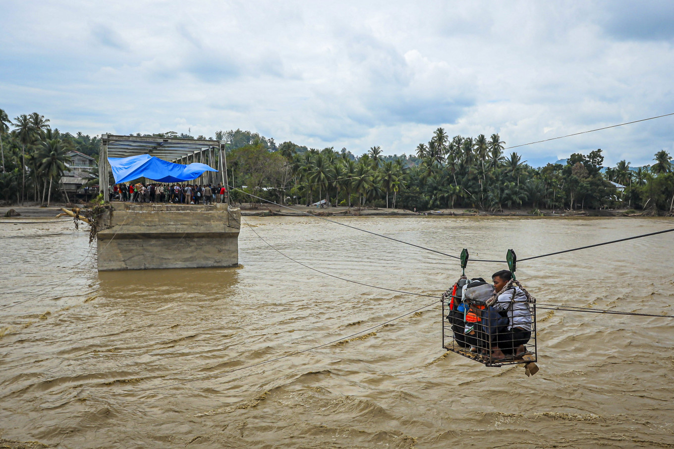 Villagers use a makeshift cable car to cross the river on Dec. 2, 2025, after the bridge was destroyed by a flash flood in Bireuen, Aceh. (AFP/Amanda Jufrian )
F
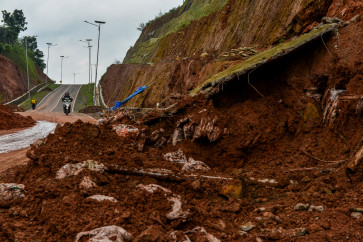
lood management is a priority for many governments around the world. Recent floods have led to hundreds of deaths and caused significant damage in Indonesia, Sri Lanka, Thailand, Vietnam, Albania, Kenya and elsewhere.
Canada, where we are, is also no stranger to floods. Notably, in 2021, flooding in British Columbia province cut off access to Vancouver city from the rest of Canada and caused up to US$14 billion in damages.
While many scientific and technical reports show that floods are becoming larger and more common, these reports may be underestimating how their frequency is changing. Flood sizes get the spotlight, however governments and experts need to also consider their frequency to address implications overlooked by traditional management methods.
Frequency and size together must tell the story, because even modest increases in size can lead to surprisingly big jumps in frequency. For example, timber harvesting in British Columbia has led to a 19 to 26 percent increase in flood size, and turned the former 100-year flood into a once-a-decade flood. Despite floods becoming more frequent, today’s practices still dominantly focus on flood size.
The consequences are severe. We can build infrastructure like dikes and dams bigger so they withstand larger once-in-a-century floods. But if we don’t capture how floods of all sizes, including the 100- and 200-year events, are becoming way more common, infrastructure can weaken and fail faster than we expect.
In our recently published study, we examined a range of scientific, technical and governmental documents to assess whether practices today help us reliably predict flood risks. We found that many of the factors contributing to the severity of a flood could respond much more strongly to climate and landscape changes than traditional methods imply, calling for change in our flood prediction practices.

Nature’s flood “ingredients” include rainfall, snow, soil wetness and energy for snowmelt, which combine in many “recipes” to trigger floods. Human influences like climate change, land use and land cover changes can alter these recipes, making floods bigger and more common. Understanding how human activity causes these effects on floods means predicting flood frequency and size together.
However, short flood records make it difficult to estimate the frequency and size of large floods. Without overcoming this challenge, assessments can produce unreliable results.
Additionally, many studies lump distant flood records with more recent records, suggesting that floods today have similar odds as those decades ago. Yet, experts agree that changes in the climate and landscape alter floods more strongly today.
These practices together produced a widespread perception in risk assessments where flood sizes rise rapidly, or steeply, per change in frequency, called a “heavier tail”.
Our recently published study challenges that perception, which implies that human influence should not greatly alter floods. In many places, human activities are making large floods more common. By giving little attention to how our activities affect flood frequencies, our practices do not seem to capture just how sensitive floods are and how much they’re changing.
Without adapting our practices, we risk the loss of lives and livelihoods, misallocating funds, economic losses and lawsuits against governments, municipalities and professionals. Reliable flood projection and management is vital.
To make reliable flood projections, we first need to identify a region’s natural flood frequencies and sizes, and which climate and landscape features drive them. With this solid baseline, we can determine how human activities shift flood frequencies and sizes, if floods are sensitive to human influence and what this means for society.
We can do this by predicting how different human activities affect floods through modelling or landscape experiments. We can work with flood records, using methods that recognize how current and future floods are far more affected by human activities than past floods.
Furthermore, we can use existing techniques to overcome challenges with short records and ensure that our estimates reflect a strong understanding of the natural and human drivers of flood frequencies and sizes.
By adopting stronger practices, our study predicts that many regions could see very different frequency-size relations, flood sizes could increase more slowly per change in frequency.
It signals a more “fragile,” or super sensitive, flood regime than what current methods imply. When we disturb the climate or landscape, large floods can react strongly; they become much more common, reflecting what we see in many places today.
This knowledge can help governments effectively manage the land while mitigating major jumps in flood frequency.
Effective flood management must include strong policies, nature-based solutions, and infrastructure designed for size and strength to withstand both larger and more frequent floods.
Nature-based solutions such as green areas, permeable surfaces and water-retaining features are being adopted by governments worldwide. Studies suggest that measures like increased forest cover have little impact on large floods, however, this may reflect the focus on flood size. Natural landscapes like forests can greatly reduce flood frequencies, even for very large floods.
In British Columbia, landscape features like mountains, forests, lakes, wetlands and floodplains spread out floods, lowering their peaks and making large events rarer. However, these same features make floods react strongly to changes in the climate and landscape.
Flood risk management must work with nature, maintaining or increasing the landscapes’ ability to store floodwaters. Our policies must address flood risk at the source through effective land management, recognizing that key causes of urban floods could lie thousands of kilometers away in the distant uplands. With strong policies and interventions both upstream and downstream, we can proactively manage floods.
---
Samadhee Kaluarachchi is a PhD student in forest hydrology and Younes Alila is a professor at the department of forest resources management, both at University of British Columbia, Canada. The article is republished under a Creative Commons license.