The Jakarta Post
Please Update your browser
Your browser is out of date, and may not be compatible with our website. A list of the most popular web browsers can be found below.
Just click on the icons to get to the download page.


Popular Reads
Top Results
No results found. Please check your search term and try again
Can't find what you're looking for?
View all search results
Popular Reads
Top Results
No results found. Please check your search term and try again
Can't find what you're looking for?
View all search resultsWhy El Niño isn’t the sole culprit of forest fires
Kalimantan’s land fires aren’t just down to El Niño; they are caused by the soil losing its ability to hold water. Prevention must start by restoring the soil’s natural balance.
Change text size
Gift Premium Articles
to Anyone
Share the best of The Jakarta Post with friends, family, or colleagues. As a subscriber, you can gift 3 to 5 articles each month that anyone can read—no subscription needed!
 Set as preferred source
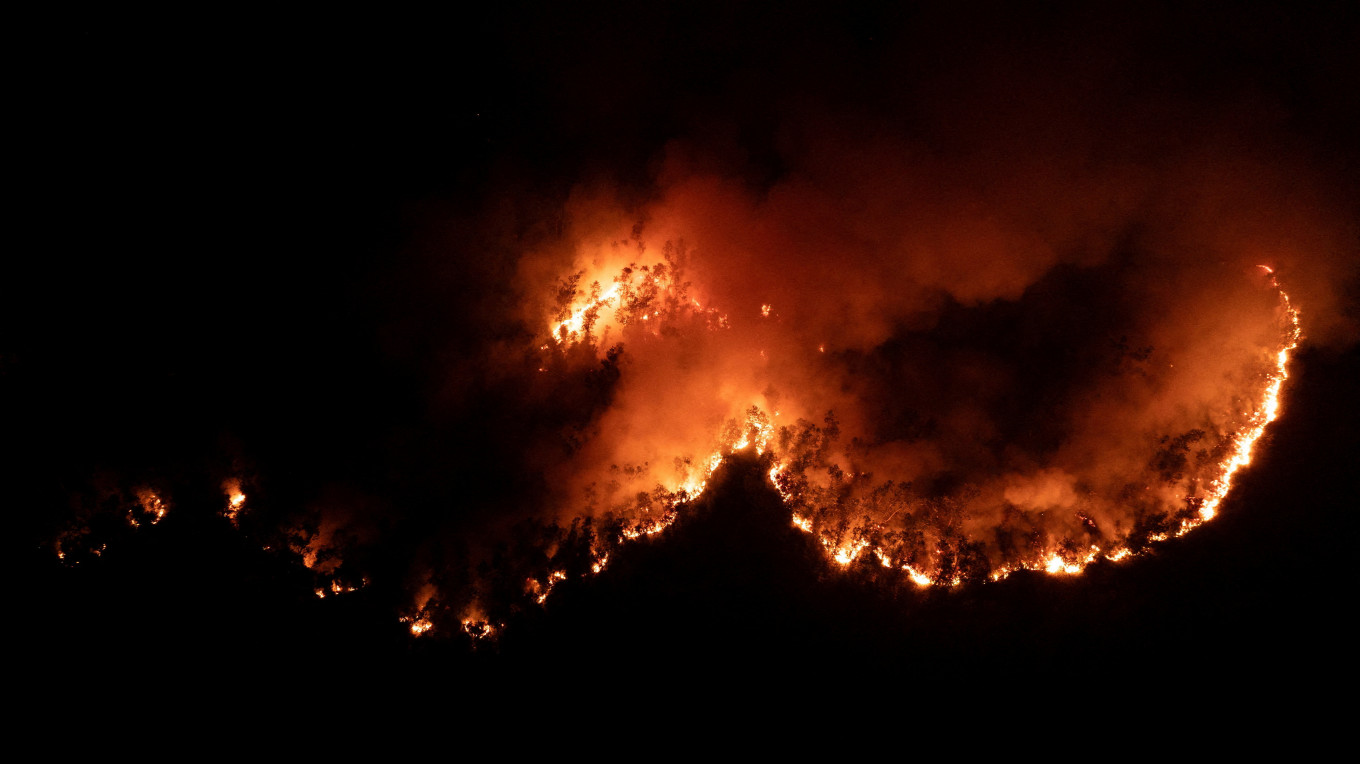 Flames rise from a wildfire on Aug. 13 in Palangka Raya, Central Kalimantan. (Reuters/Ajeng Dinar Ulfiana)
F
orest and land fires across Indonesia have spiked once again. News and social media in the country are flooded with images of thick plumes of smoke from Kalimantan in Borneo — the world’s third largest island — choking residential areas and drifting into neighboring countries.
It is tempting to write this off as a purely weather-driven crisis: the dry season is well underway, and a strengthening El Niño is driving temperatures toward predicted historic highs around the globe.
While these conditions undoubtedly amplify the risk, the crucial question is not just why El Niño’s impact is so severe — it is why parts of the landscape have become so flammable in the first place. Unsurprisingly, human activity plays a major role.
Fires don’t start in a vacuum. Major infernos happen when dry weather meets a Bornean landscape that has lost its natural capacity to retain water due to expansion of industrial plantations such as pulpwood and oil palm — an irreversible loss that has been increasing for decades.
Our analysis draws on data from NASA’s Fire Information for Resource Management System (FIRMS) — a satellite-based monitoring system providing near-real-time fire activity data.
To track how fire activity has evolved, we analyzed detection data from two satellite instruments with different spatial resolutions: MODIS (approximately 1-kilometer resolution) and VIIRS (375-meter resolution). Analysis across Kalimantan’s five provinces reveals a sharp uptick in fire activity leading into mid-August.

On Aug. 18, MODIS via FIRMS detected roughly 5,206 thermal anomaly pixels across Kalimantan. At a resolution of roughly one km, the observation pixel area totals 520,600 hectares — though this figure does not reflect the actual burned area.
Meanwhile, VIIRS data shows that West Kalimantan recorded the highest cumulative detections, with 82,728 active pixels at nominal-to-high confidence levels between Aug. 1 and 18. Central Kalimantan followed with 34,105 pixels, East Kalimantan with 20,686, South Kalimantan with 16,602 and North Kalimantan with 5,157.
Given the 375-m resolution of the VIIRS sensor, these detections collectively cover a total pixel area of roughly 2.24 million ha.
It is important to note that this figure does not mean 2.24 million ha of burned area (burn scar). That figure simply multiplies the total number of detected pixels by the area of a single pixel. Thermal signatures in satellite imagery can indicate either small but high-intensity fires or broad sprawling blazes.
Indonesia has repeatedly paid a devastating price for forest and land fires. The catastrophic fire seasons of 1997–1998, 2015 and 2019 demonstrated a predictable pattern: droughts striking severely degraded landscapes.
The World Bank estimated economic losses from the 2015 fires at US$16.1 billion — roughly 1.9 percent of Indonesia’s GDP.
Four years later, history repeated itself. The World Bank’s analysis of the 2019 fires estimated damages and economic losses at around $5.2 billion, or approximately 0.5 percent of GDP.
This cycle proves that land fires cannot simply be treated as natural weather disasters. El Niño weather patterns come and go, but landscape vulnerability persists for decades.
A recent study published in Natural Hazards underscores this reality. El Niño increases the risk of mega-fires in Kalimantan matching or exceeding the 1997 and 2015 events by roughly 2.7 times. Yet, severe fires continue to break out across all ENSO phases (both El Niño and La Niña).
Discussions surrounding land fires often focus on flame, smoke, wind and rain. Soil is usually an afterthought, even though that is where the problem originates.
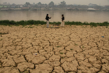
Soil plays a fundamental role in water storage. Soil structure, organic matter, porosity, groundwater levels and vegetation cover determine how long moisture remains after the rain stops. When these natural functions are disrupted, landscapes become hyper-sensitive to dry spells.
This is especially critical given that 4.5 million hectares of Kalimantan consist of peatland — ecosystems naturally formed under waterlogged conditions. As long as water tables remain high, peat is naturally resilient to fire.
However, drainage networks constructed to clear peatlands for plantations have upended that balance. Draining peatlands through canals speeds up soil drying and breakdown.
Research on the physical properties of Indonesian peat demonstrates that declining groundwater levels are a primary driver of peatland degradation and fires, particularly during El Niño. The presence of drainage canals is linked to an increased fire probability roughly 4.5-fold.
On mineral soils, fires leave lasting scars. A study in the Journal of Forestry Research reveals that high-intensity fires deplete organic matter, destroy soil microorganisms, break down its stability and make the soil water-resistant.
This creates a vicious cycle: dry soil fuels fires, and fires leave the soil even more vulnerable to future degradation and drought.
While powerful, El Niño conditions alone do not explain why fires mostly recur in the exact same area.
Weather dictates when a landscape becomes flammable; soil and land management determine how easily fires ignite, spread and persist.
Although government agencies battle blazes through ground efforts, aerial firefighting, patrols and cloud seeding, rigorous law enforcement remains vital — particularly against concession holders who fail to protect their land from fires. Long-term strategies must move towards true prevention. This means halting further peatland conversion.
Restoring degraded peatlands is equally critical: maintaining their water level, blocking peat canals, and restoring vegetation. A study in Nature Communications estimates that restoring 2.49 million ha of degraded peatland could save US$8.4 billion in avoided fire impact.
Additionally, central and local governments must integrate soil moisture and peat-water level monitoring into fire early warning systems.
Fires are not merely thermal events. They are symptoms of a disturbed relationship between water, soil, vegetation and human activity.
If Indonesia continues to act only after hotspots appear, we will forever be stuck playing catch-up with active blazes.
Real prevention starts long before the smoke rises: by ensuring the land retains its water and preserves its ecological resilience.
---
 Frisa Irawan Ginting is a lecturer in soil science and land resources and Dian Fiantis is a
professor of soil science, both at Andalas University. This article is republished under a Creative Commons license.