TheJakartaPost
Please Update your browser
Your browser is out of date, and may not be compatible with our website. A list of the most popular web browsers can be found below.
Just click on the icons to get to the download page.

Popular Reads
Top Results
No results found. Please check your search term and try again
Can't find what you're looking for?
View all search resultsPopular Reads
Top Results
No results found. Please check your search term and try again
Can't find what you're looking for?
View all search resultsPetaBencana.id offers real-time flood updates via interactive map
Change text size
Gift Premium Articles
to Anyone
Share the best of The Jakarta Post with friends, family, or colleagues. As a subscriber, you can gift 3 to 5 articles each month that anyone can read—no subscription needed!
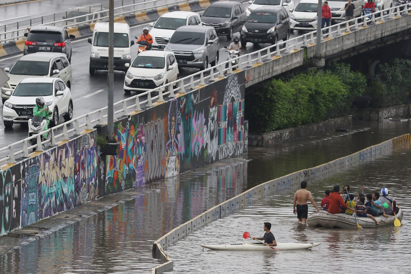 Residents ride on a rubber boat and a canoe next to an inundated road in Grogol, West Jakarta, on Wednesday. (JP/Dhoni Setiawan)
Jakarta residents are now able to access the latest updates on floods through an interactive map at PetaBencana.id.
The website shows which areas are on high alert and which areas are considered safe. The alert levels of areas are distinguished by color and, when clicked, provide information on the location, water level and latest updates on the flooding situation of the area.
High-alert areas are marked in red, meaning that the floodwater in the area is more than 150 centimeters deep; medium-alert areas are marked in orange (71 cm to 150 cm); low-alert areas are colored yellow (10 cm to 70 cm). Meanwhile, green areas indicate that people need to prepare for incoming floods.
According to KompasTekno, PetaBencana.id also provides flood information for other cities, including Surabaya, Bandung and Semarang.
The website also enables its visitors to report on the real-time flooding situation with the Twitter hashtag #banjir (flood) via @petabencana, send messages through Peta Bencana’s Facebook at @petabencana.id, or text /banjir to their bot @bencanabot on Telegram.
PetaBencana.id is a joint project involving the National Disaster Mitigation Agency (BNPB), Pacific Disaster Center and the Humanitarian OpenStreetMap Team. (dpk)