The Jakarta Post
Please Update your browser
Your browser is out of date, and may not be compatible with our website. A list of the most popular web browsers can be found below.
Just click on the icons to get to the download page.


Popular Reads
Top Results
No results found. Please check your search term and try again
Can't find what you're looking for?
View all search results
Popular Reads
Top Results
No results found. Please check your search term and try again
Can't find what you're looking for?
View all search resultsEarly warning of disasters key as it can save lives
From 19th-century Himalayan telegraphs to real-time satellite ocean grids, history proves that disasters are inevitable—but mass casualties are not, provided we heed the warning in time.
Change text size
Gift Premium Articles
to Anyone
Share the best of The Jakarta Post with friends, family, or colleagues. As a subscriber, you can gift 3 to 5 articles each month that anyone can read—no subscription needed!
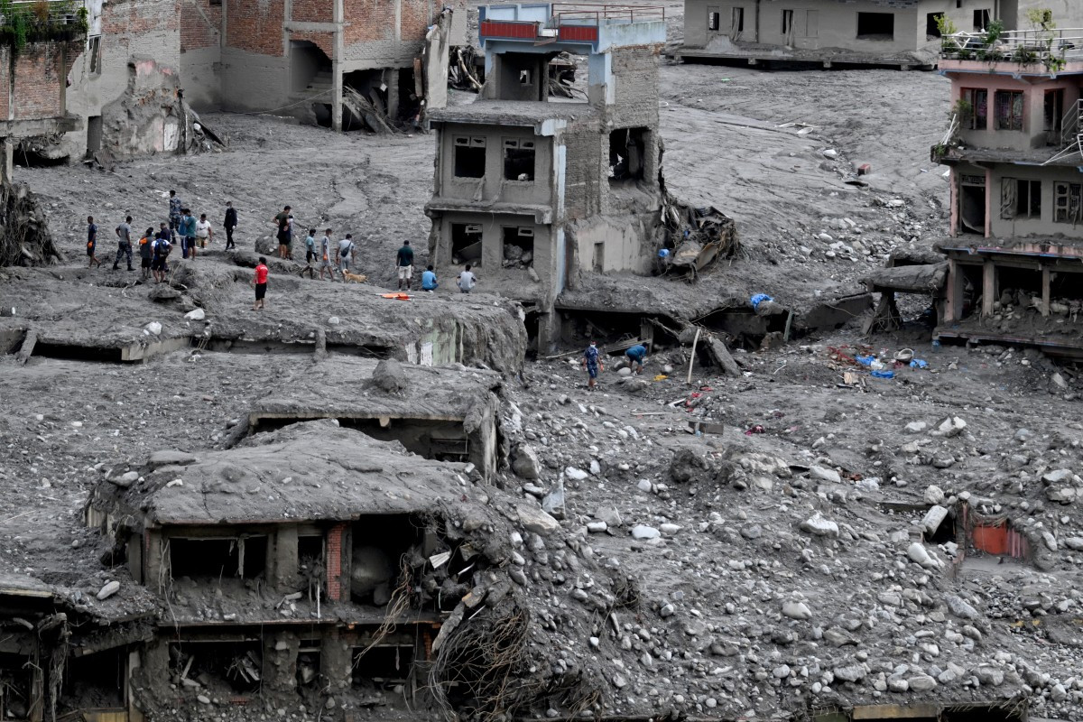 People scout for usable materials from debris on Sept. 1 after flash floods at Trishuli Center in Nepal's Nuwakot district. The huge wave of freezing water and debris, sparked by a glacial collapse on the China-Nepal border, killed at least 939 people and left nearly 4,500 missing, with Kathmandu warning reconstruction costs could run into the “billions of dollars“. (AFP/Arun Sankar)
I
n September 1893, a massive rockfall completely blocked the Birahi Ganga River valley in the Indian Himalayas, constructing a natural landslide dam that stood over 300 meters high. This created a large, deep body of water called Gohna Lake.
Although a massive portion of the dam initially broke in 1894—destroying downstream towns such as Srinagar—the lake was not emptied entirely and remained a prominent feature for decades.
During the severe Himalayan floods of 1924, the remaining landslide dam breached a second time, unleashing another devastating wave down the Alaknanda Valley. However, despite these catastrophic events taking place in a highly fragile mountainous region, no lives were lost in either 1894 or 1924, thanks to an early warning system that was established even back then.
In the context of recent landslides and horrific floods in Nepal, questions are being raised about whether an effective early warning system could have been in place. In one notable instance, headmaster Rajendra Dawadi of Tribhuvan Trishuli School received a warning a few minutes in advance; he promptly rang the bell, turned school buses back, and successfully saved the lives of 1,643 children.
The Indian Ocean Tsunami Warning and Mitigation System (IOTWMS) provides real-time alerts and threat assessments to protect nations bordering the Indian Ocean basin from destructive tsunamis. It was created following the deadly December 2004 Indian Ocean earthquake and tsunami that killed nearly 250,000 people, mostly in the Aceh province of Indonesia.
Operations rely on three designated national centers—Australia (JATWC), India (ITEWC) and Indonesia (InaTEWS)—which monitor seismic and sea-level activity around the clock. Land-based seismographs and seismic stations detect undersea earthquakes and calculate their magnitude within minutes.

Seafloor bottom pressure recorders detect pressure changes caused by passing tsunami waves and transmit the data via satellite to warning centers, while coastal tide gauges monitor sea-level changes in real time to verify whether a wave has formed. Regional Tsunami Service Providers (TSPs) process this incoming data and issue risk assessments to national warning centers, which then alert local populations. Disasters happen, but early warnings save lives.