TheJakartaPost
Please Update your browser
Your browser is out of date, and may not be compatible with our website. A list of the most popular web browsers can be found below.
Just click on the icons to get to the download page.

Popular Reads
Top Results
No results found. Please check your search term and try again
Can't find what you're looking for?
View all search resultsPopular Reads
Top Results
No results found. Please check your search term and try again
Can't find what you're looking for?
View all search resultsDeteriorating Palu-Koro fault amplified quake's jolt
The fault’s shift is believed to have triggered the major earthquake that struck on Friday.
Change text size
Gift Premium Articles
to Anyone
Share the best of The Jakarta Post with friends, family, or colleagues. As a subscriber, you can gift 3 to 5 articles each month that anyone can read—no subscription needed!
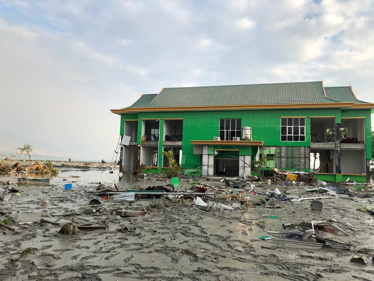 A still-standing building is surrounded by the rubble of houses flattened by the 7.4 strong earthquakes in Palu on Friday. Courtesy of the BNPB (Bnpb/Bnpb)
T
he Center of Volcanology and Geological Hazard Mitigation has said the deteriorating Palu-Koro fault had amplified the jolt of the 7.4-magnitude earthquake that hit Donggala regency in Central Sulawesi.
The fault is a fracture in the earth’s crust that runs from the Makassar Strait to the northern part of the Boni Gulf in southern Sulawesi. It runs underneath Sulawesi Island.
The fault’s shift is believed to have triggered the major earthquake that struck on Friday.
“The geological map of Central Sulawesi is composed of rocks that are aged between 10,000 and 1 million years. But it fell into decay, causing the jolts to be stronger,” said the institution’s head of earthquake mitigation, Sri Hidayati, on Saturday.
Sri, who is involved in compiling the 2017 Indonesia Earthquake Map, said it was an active fault with a motion that ranged between 30 and 44 millimeters per year.
She added that the agency had sent the map of vulnerable land motion to local governments nationwide.
Sri suggested that local governments should utilize the geological maps as a reference point to implement policies regarding land utilization and spatial development, as well as the construction of earthquake-resistant infrastructures.
“We are hoping that local governments utilize the [geological] maps as one of the considerations for spatial planning in their respective areas. For instance, if there is an active fault within an area, do not allow the construction of buildings,” she emphasized.
Indonesia, which sits on the so-called Ring of Fire, is one of the most disaster-prone countries in the world. The 2017 national earthquake map revealed that the number of active faults across the nation has increased from 81 to 295 since 2010. (sau/dmr)