TheJakartaPost
Please Update your browser
Your browser is out of date, and may not be compatible with our website. A list of the most popular web browsers can be found below.
Just click on the icons to get to the download page.

Popular Reads
No popular reads data found
Top Results
No results found. Please check your search term and try again
Can't find what you're looking for?
View all search resultsPopular Reads
No popular reads data found
Top Results
No results found. Please check your search term and try again
Can't find what you're looking for?
View all search resultsforest-fires
Archipelago 1 week ago
PREMIUM
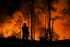
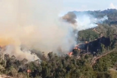
Thick smoke from Riau forest fires disrupts Idul Fitri exodus
According to satellite imagery analysis by the Forestry Ministry, forest and land fires in Riau burned around 4,400 ha of land between January and February 2026, with about 94 percent of the affected area located on peatland.
Archipelago 1 week ago
PREMIUM
Indonesia braces for wildfire, drought ahead of longer dry season
Several wildfire-prone regions in Sumatra and Kalimantan have issued fire alerts as the weather agency predicts a longer dry season starting later this month that may lead to crop failures and increase the risk of severe drought.
Archipelago 1 month ago
PREMIUM
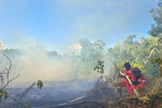
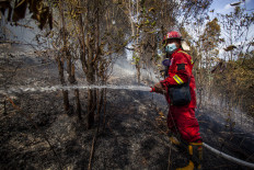
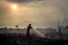
Cloud seeding helps induce rain as Riau continues to battle wildfires
A cloud seeding operation has helped in firefighting efforts as Riau continues to battle hot spots and wildfires that have burned through at least 564 hectares across several regions over the past three weeks.
Archipelago 2 months ago
PREMIUM
Forest fires break out in Sumatra, Kalimantan despite ongoing rainy season
The Meteorology, Climatology and Geophysics Agency (BMKG) detected 190 fire hotspots across Sumatra on Monday, with Aceh recording the highest number at 110, followed by North Sumatra with 43.
Archipelago 2 months ago
PREMIUM
Land, forest fire cases in Riau jumped by 205 percent in 2025
Increase in enforcement did not mean that forest and land fires were getting out of hand but showed the seriousness of law enforcement in against land and forest fire perpetrators, Riau Police chief Insp. Gen. Herry Heryawan said.
Archipelago 4 months ago
PREMIUM
North Sumatra resident nabbed in Riau for causing forest fire
Police have arrested a North Sumatra resident for allegedly causing a forest fire in Rokan Hilir regency in Riau. The forest fire had been detected through the Lancang Kuning hotspot detection app since at about 3 p.m. on Oct. 30.
Society 6 months ago
PREMIUM
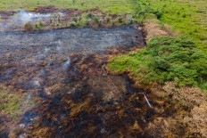
Forest fire still high in 2025 despite wetter dry season
Of at least 218,000 hectares with indications of being burned between January and August this year, nearly half were located in concession areas linked to oil palm, oil and gas and mineral mining businesses, a report discovered.